Kullaberg Peninsula
Henrik Johansson
Calazo förlag
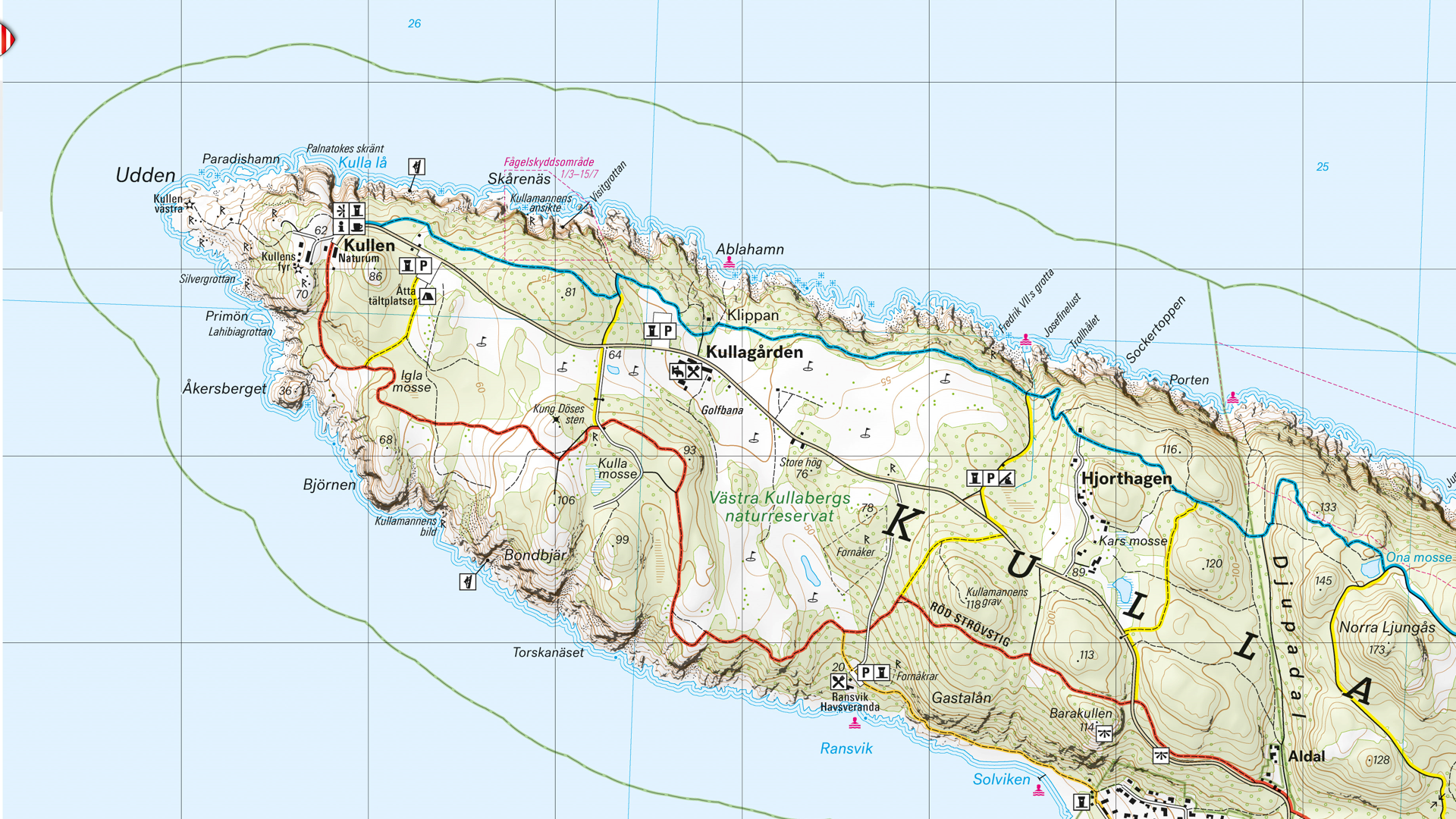
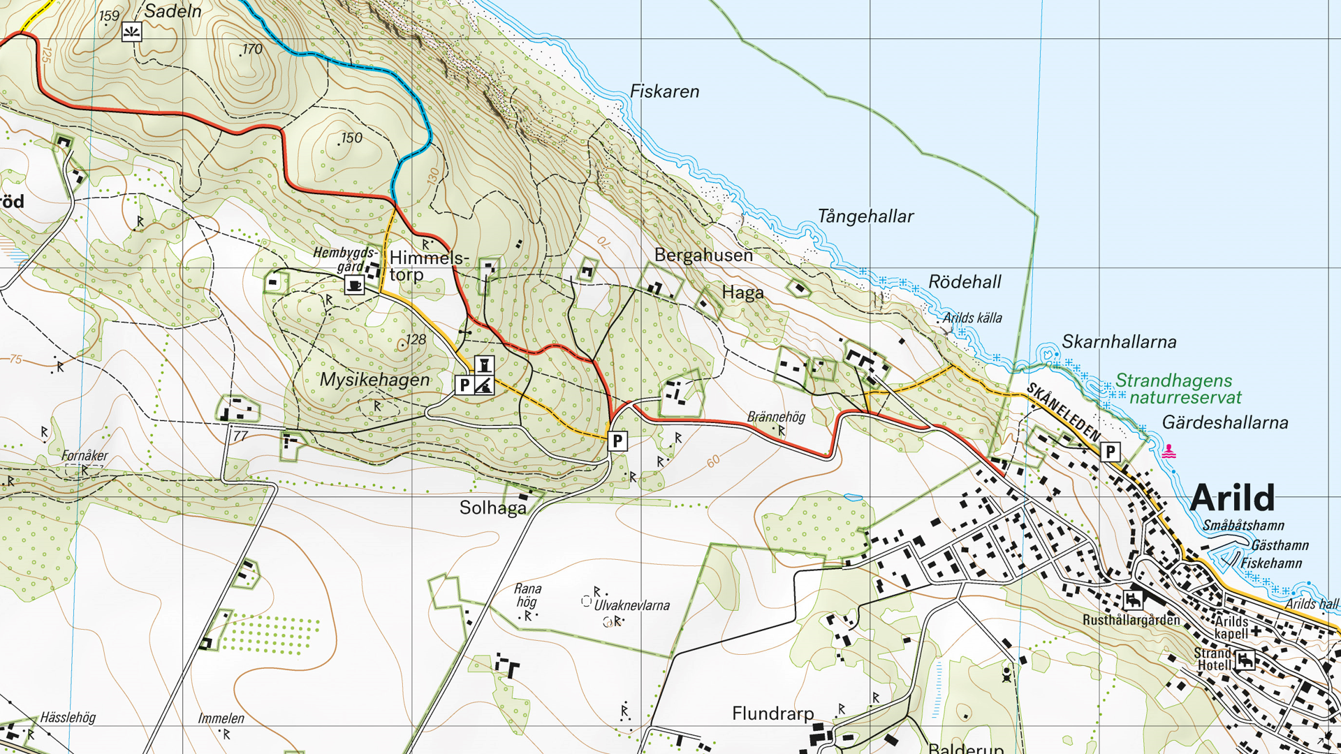
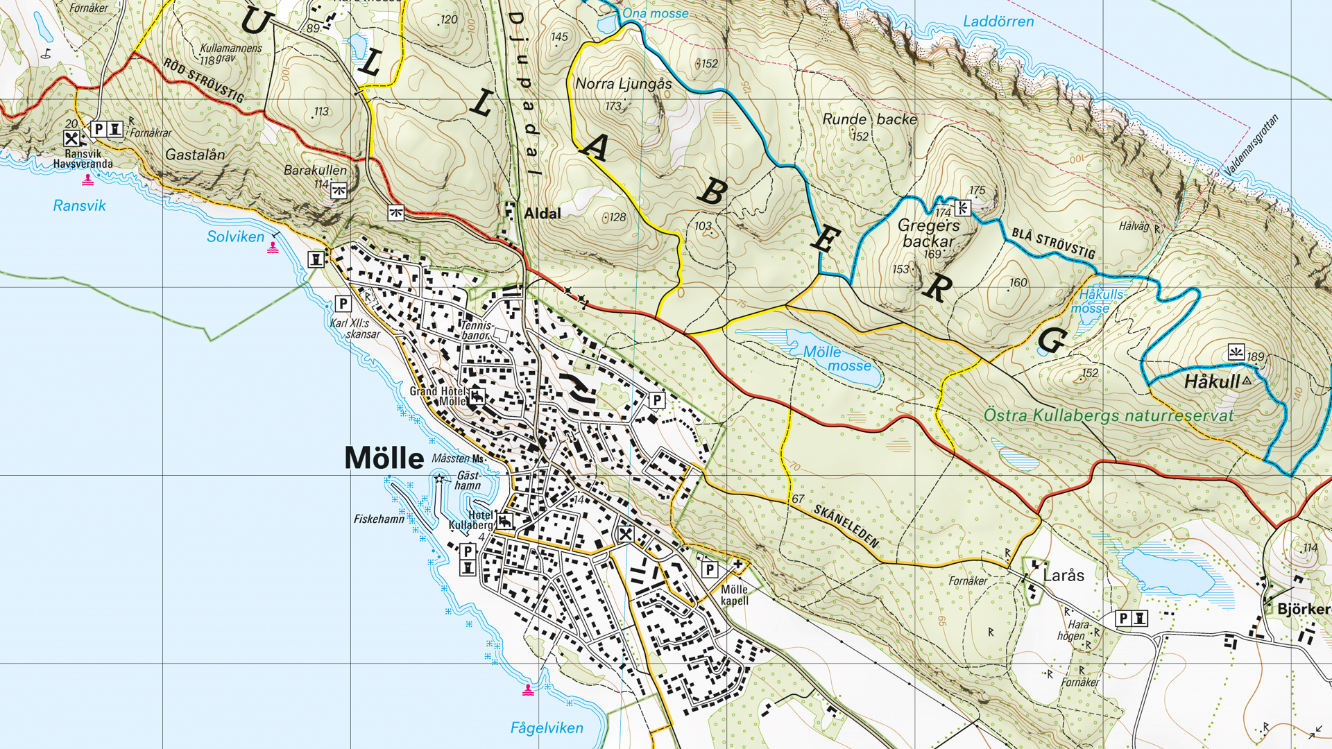
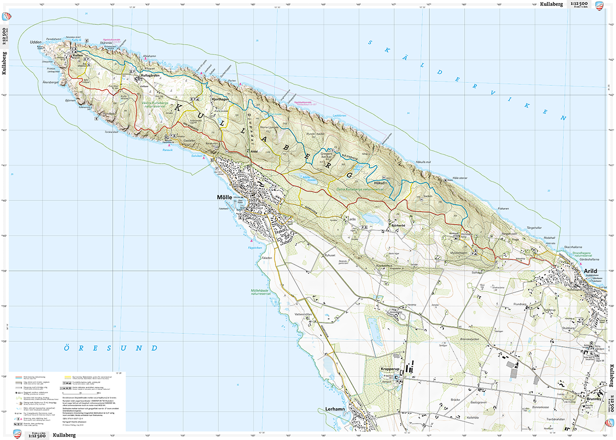
This topographic hiking map focuses on the Kullaberg peninsula and nature reserve located in southwestern Sweden. The region is characterized by steep cliffs rising from the sea and a high ridge that emerges above the surrounding terrain. This map utilizes hill shading to give the rock face prominence and visualize the dramatic changing terrain. Major landmarks and significant points of interest are shown for visitors to the area.
A grid system allows for easy referencing and location of important features, and major trail systems are highlighted for efficient interpretation.