Tongass National Forest Lightbox
Evan Applegate
Applegate Maps
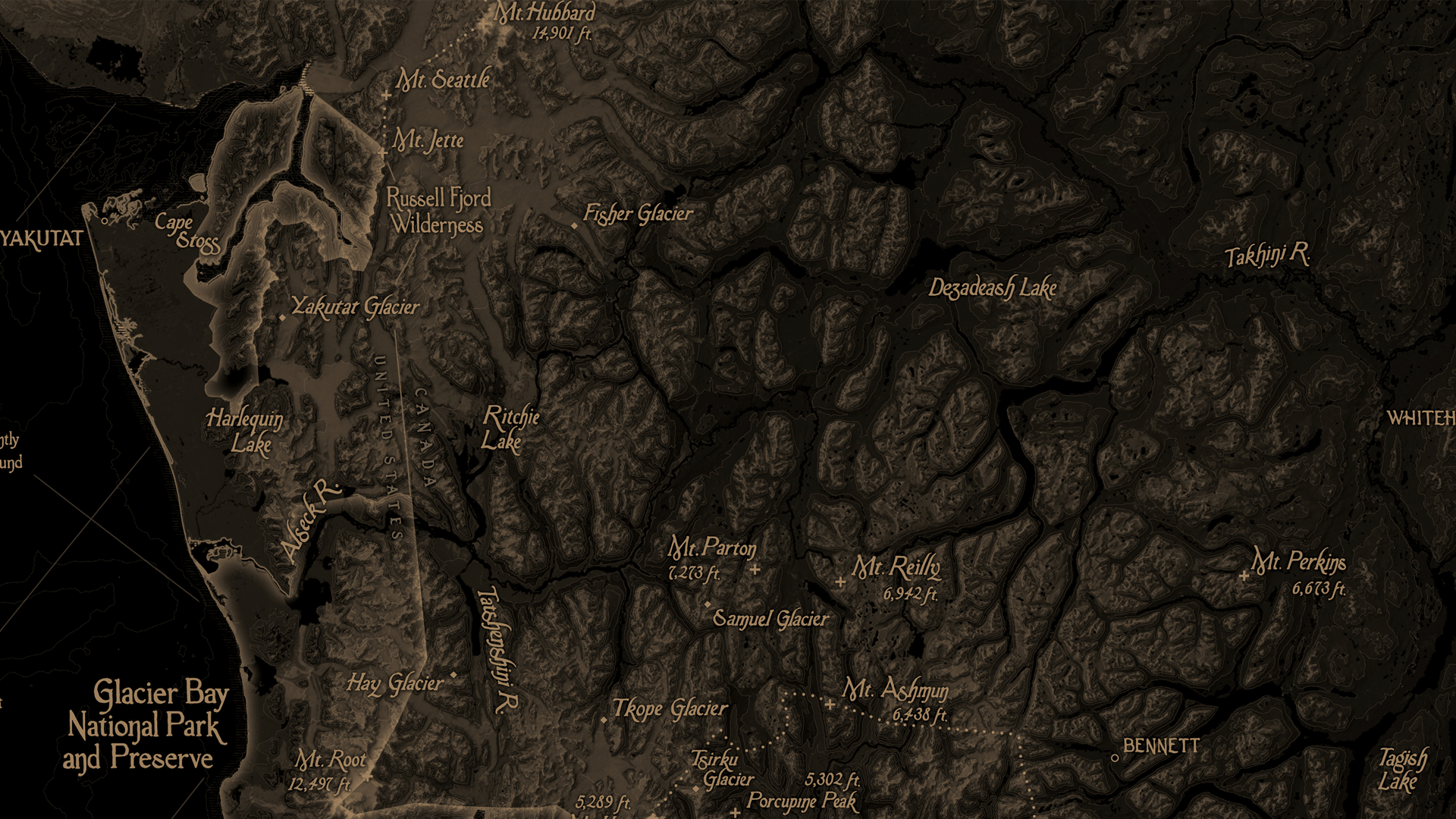
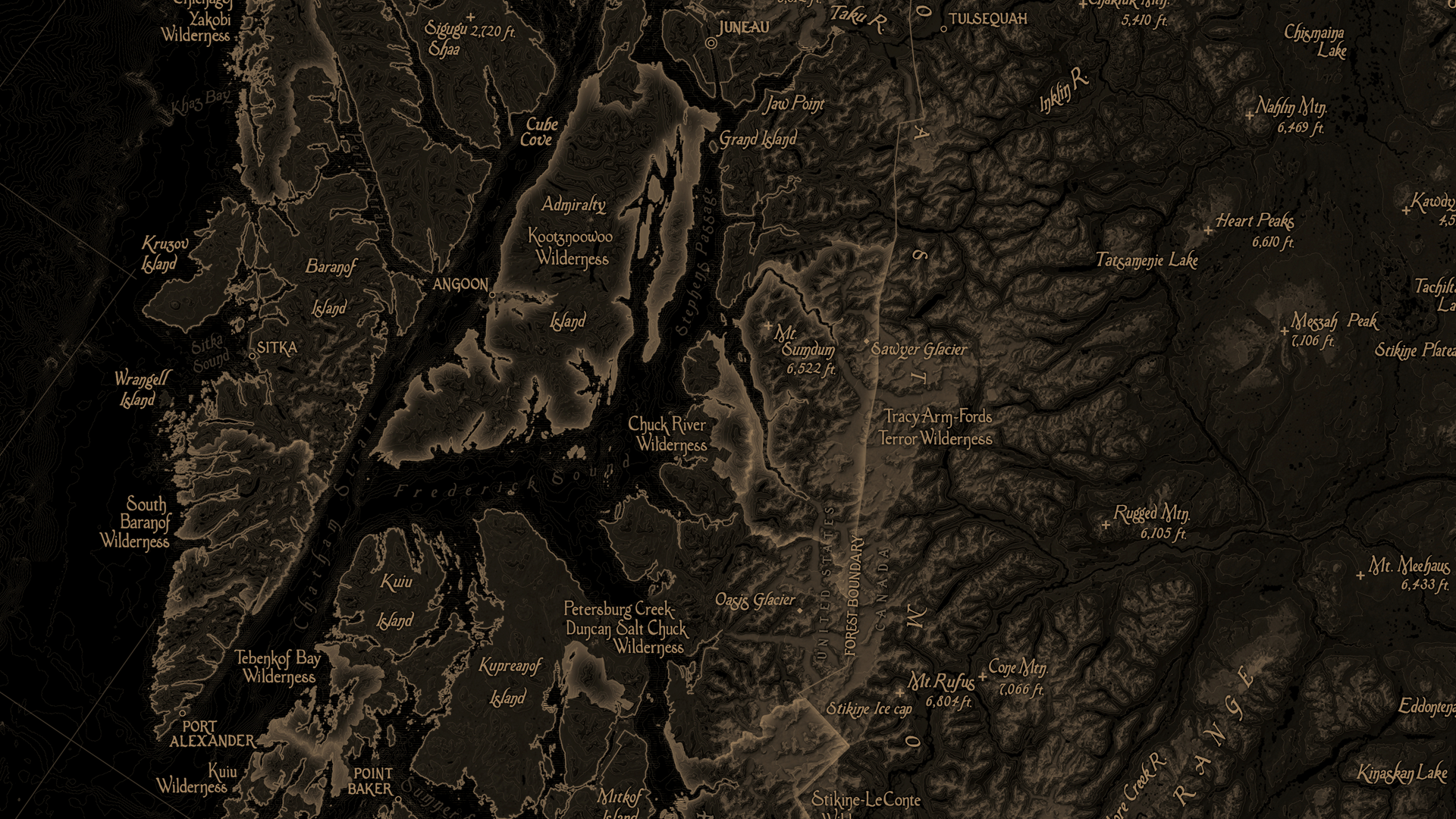
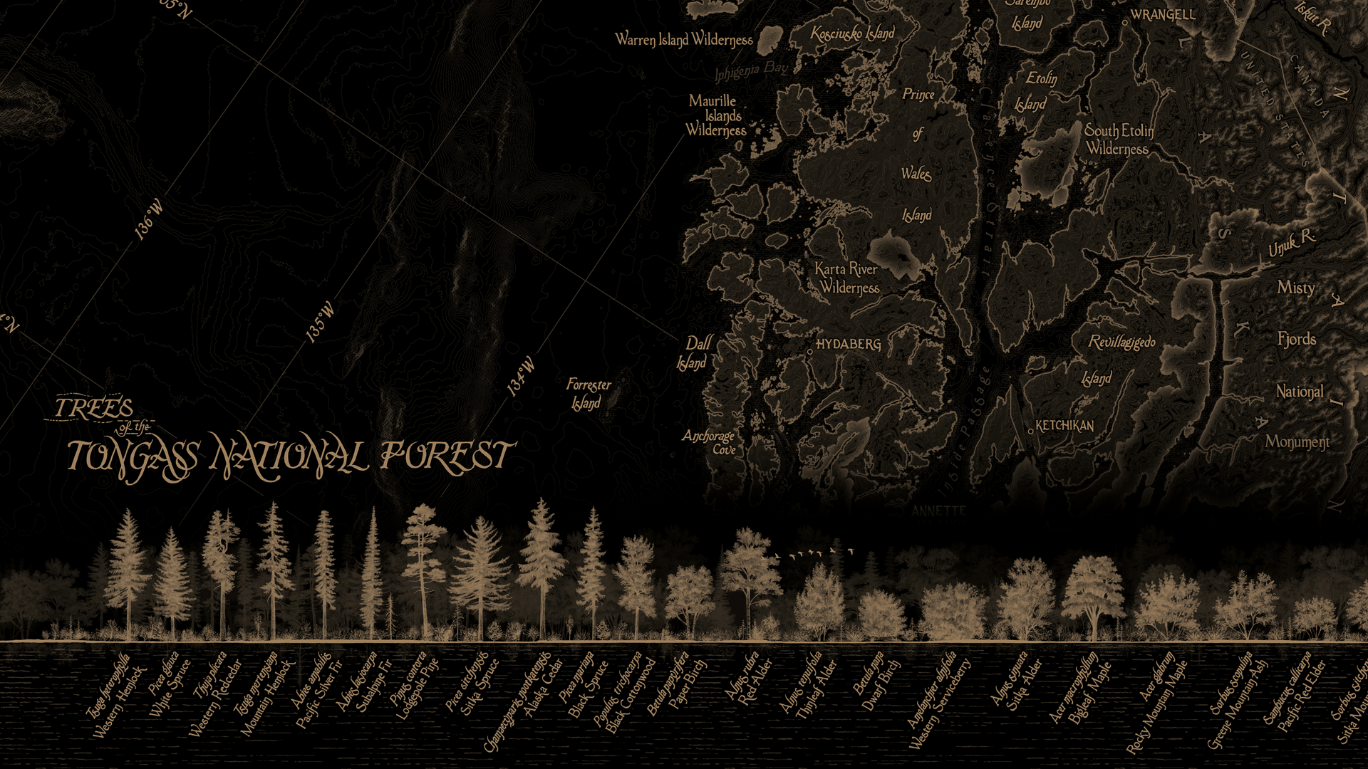
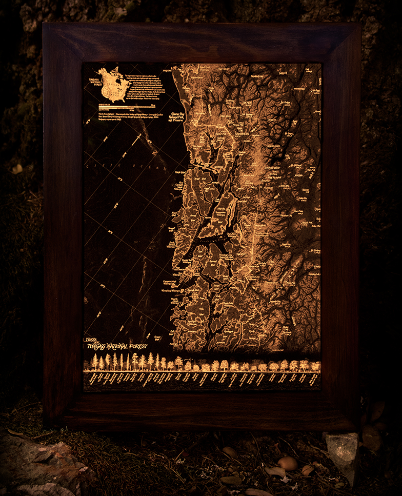
This 100% hand-lettered map features 28 illustrations of trees you’ll find in the Tongass National Forest, the largest intact temperate rainforest on Earth. The Tongass encompasses a few dozen big islands and innumerable small ones overrun with vegetation, mist-wreathed peaks, fjords and glaciers. The region is home to many, including bears, wolves, black-tailed deer, moose, salmon, and ancient murrelets. The map showcases the region’s dramatic terrain by combining shaded relief with subtle lines of topography. Major peaks, parks, and other natural features are individually labeled.
The map is printed on a 12”x18” 3600-DPI film and mounted in a lightbox illuminated by a candle.
Additional credits:
Tree illustrations by Matt Strieby, understory illustrations by Aiyana Udesen, lettering by Ezra Butt