


Avenza Resources Blog
MAPublisher is popular with educators and students because, in no time at all, new users…
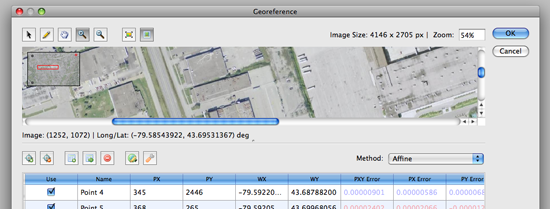
As of Geographic Imager 5.0, there’s an updated workflow for georeferencing images. Learn more about…
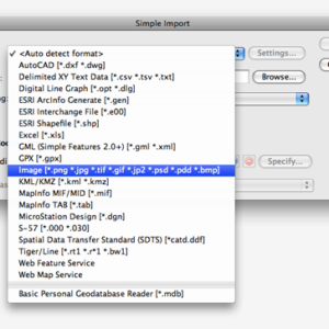
MAPublisher 8.4 introduces two new related features: to import supported image formats directly from the…
If you haven’t read about it yet, USGS topographic maps for the United States are…
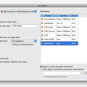
The upcoming release of MAPublisher 8.4 introduces many new features. One of the new features…
When transforming a world image, there may be artifacts created by the Geographic Imager transformation…
One of the great advantages of using Adobe Illustrator for a mapping project is that…

Here we have placed point symbols for a MAP Point layer. However, we want to…
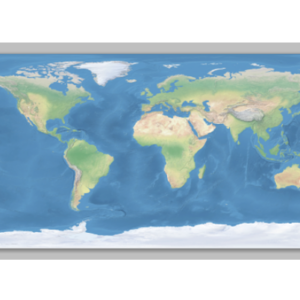
When transforming a world map in a geodetic system (such as WGS84) to a predefined…