


Avenza Blog
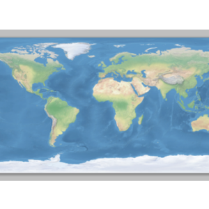
When transforming a world image, there may be artifacts created by the Geographic Imager transformation…
One of the great advantages of using Adobe Illustrator for a mapping project is that…

Here we have placed point symbols for a MAP Point layer. However, we want to…
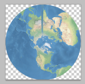
When transforming a world map in a geodetic system (such as WGS84) to a predefined…
MAPublisher offers a variety of labelling options, ranging from the MAP Tagger tool used for…
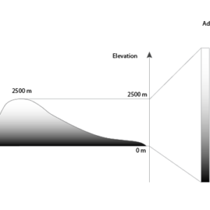
If your workflow involves Terrain Shader, specifying a DEM schema is an important step, especially…
The upcoming release of Geographic Imager 3.2 introduces a new feature called Terrain Shader, used…
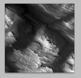
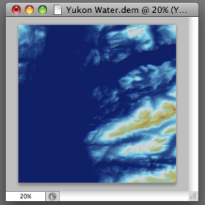
In a previous blog, we showed you how to create a shaded relief image from…

After generating a scale bar, it is placed in a MAP Legend layer. You can…