The Cartography and Geographic Information Society (CaGIS) promotes interest in map design and significant design advances in cartography. Avenza Systems sponsors several awards for the Student Entries at the Annual Map Design Competition which is open to all map makers in Canada and the United States. Students are highly encouraged to apply to this competition
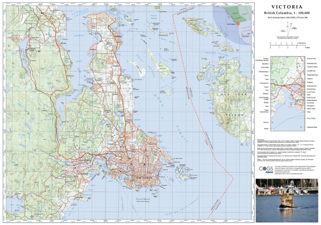
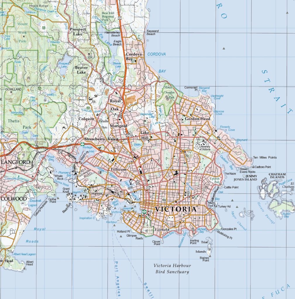
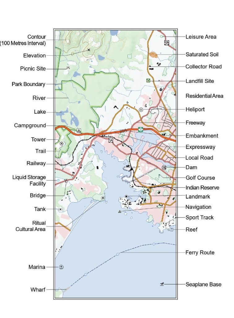
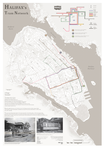
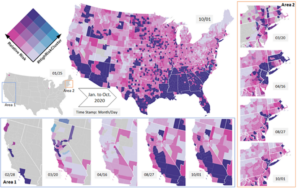
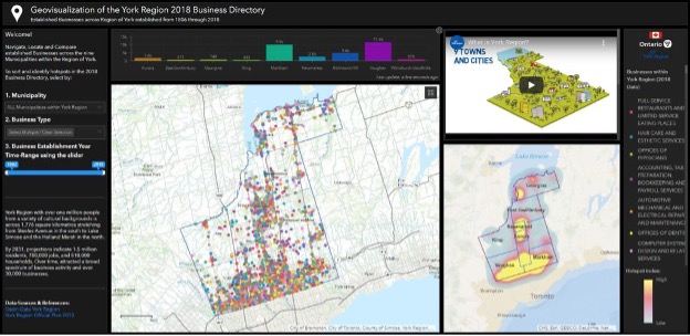
The winners of the Annual Map Design Competition 2020 include aspiring map makers from many schools throughout North America. Avenza is proud to announce that the winners of the David Woodward Digital Map Award are Yu Lan and Sridhar Lam for their maps titled ‘The Animated Bivariate Map of COVID-19’ and ‘Geovisualization of the York Region 2018 Business Directory’, respectively. In addition, Avenza is proud to announce that the winners of the Arthur Robinson Print Map Award are Kevin Chen and Nicholas Weatherbee for their maps titled Victoria and the Halifax Tram Network, respectively.
“We used the bivariate map to represent the daily relative risk and the number of days that a county has been in a cluster. In this product, users are able to discover the space-time pattern by watching and playing with the animated and interactive map.“ – Yu Lan, Ph.D. Student, UNC Charlotte
“Overall, the dashboard provides an effective geovisualization with a spatial context and location detail of the York Region’s 2018 businesses. The dashboard design offers a dark theme interface maintaining a visual hierarchy of the different map elements such as the map title, legend, colour scheme, colour combinations ensuring contrast and balance, font face selection and size, background and map contrast, choice of hues, saturation, emphasis etc.” – Sridhar Lam, Master of Spatial Analysis, Ryerson.
“This map aims to produce a detailed, accurate, and visually appealing topographic map of Victoria, British Columbia. It was generalized using data from two different scales to a final scale of 1:100,000. Hillshades were created to enhance the terrain visualization. My goal is to start a meaningful career in cartography and GIS” – Kevin Chen, Nova Scotia Community College