My Account     Contact Us     Cart

MAPublisher 10.1 Released

We’re excited to announce that we’ve released MAPublisher 10.1 for Adobe Illustrator. The MAPublisher product team has been working closely with our customers to build these features to improve map design productivity.

MAPublisher 10.1

MAPublisher 10.1

This update contains new features and performance improvements as well as fixes for reported bugs. Some highlights are mentioned below, for the full release notes see below.

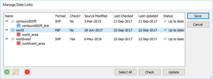
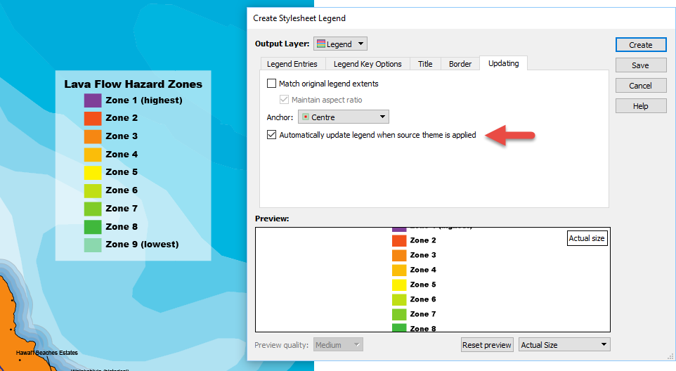
Automatically update existing legends when MAP Themes are modified. It’s here! MAP Theme legends are can now be automatically updated when legend items are updated in a theme. This is great time saver when you’re in the fine-tuning phase of selecting the right colour palette for your map and there is no need to manually update your legend.

Automatically update legends

New ability to create lines from text on a path. Creates a line based on a text on a path source. It’s useful for creating map features and to assist in indexing for manually created maps (i.e. scenarios where text was created manually instead of being created from attribute values). The text utility can be applied to text on a specific layer, on a specific MAP View, on the entire document or only selected text.

Create text on a path

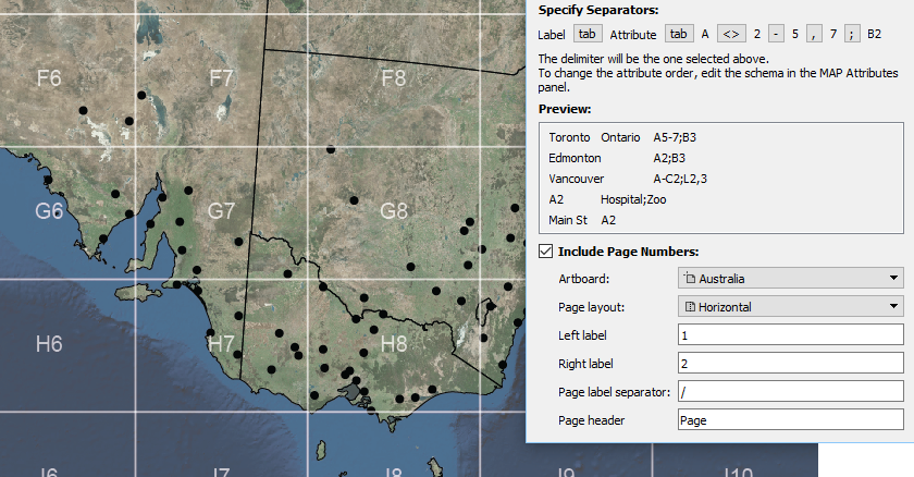
New ability to include page numbers when creating indexes. In the Make Index tool, a new Include Page Numbers option provides the ability to split a single artboard (horizontally or vertically) at the middle point to make indexes that include a reference to a page (left or right, top or bottom). This feature is useful when a map spreads over a single artboard that is intended to be split into two pages in a final output (e.g. a spread in an atlas). Text and features that span both “pages” can be listed in the index as appearing on both pages (i.e. indexing the extents of the text or feature).

Make Index page numbers

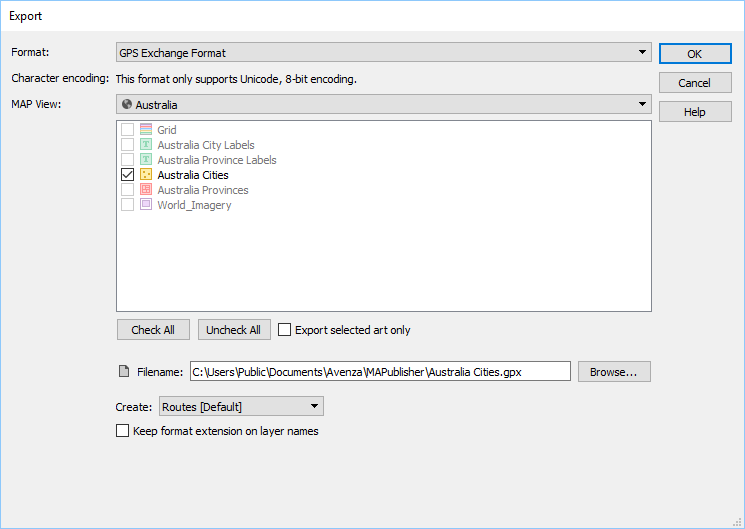
Export to GPS Exchange format (GPX) now supported. MAPublisher has long supported GPX import and now supports GPX export. It’s a format that contains contain tracks, routes and points and used to exchange data between GPS units and mapping software. It is compatible with the Avenza Maps app and many other third-party applications.

MAPublisher GPX export

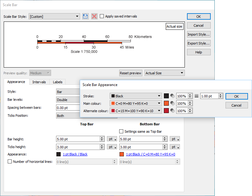
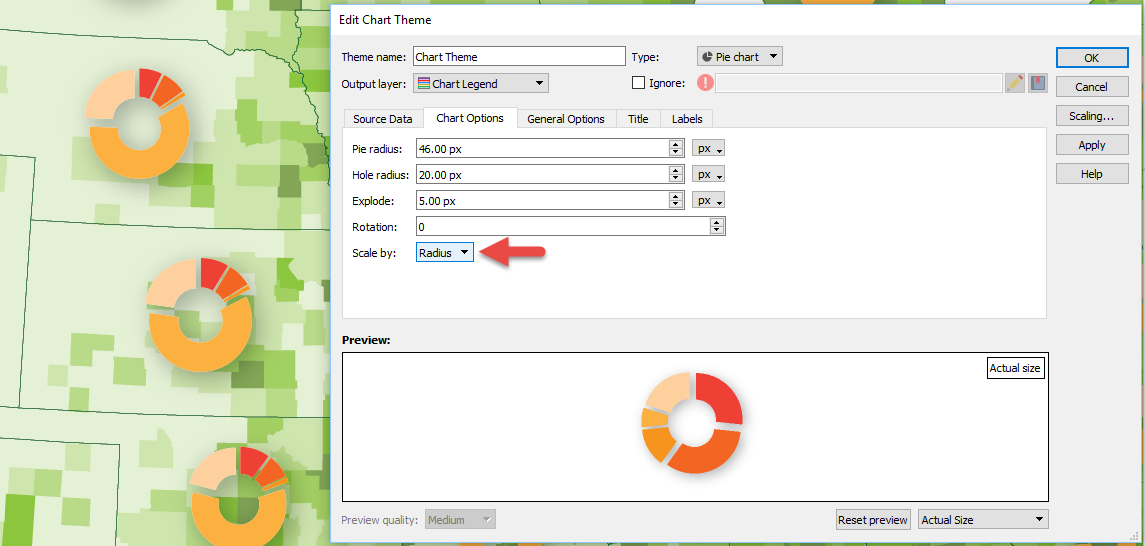
New ability to scale charts by radius. You now have the ability to scale MAP Chart Theme pie charts by radius, in addition to the existing method of using area. This provides another level of fine-tuning while adjusting charts to get proportional scaling correct. Remember that there are advanced scaling features available in the Scaling dialog box (just click the Scaling button). Learn more about chart scaling here.

Scale by radius

MAPublisher 10.1 Release Notes

  • Automatically update existing legends when MAP Themes are modified
  • New ability to create lines from text on a path
  • New ability to include page numbers when creating indexes
  • Export to GPS Exchange format (GPX) now supported
  • New ability to scale charts by radius
  • A number of user interface and usability enhancements.


MAPublisher 10 Released

We’re excited to announce that we’ve released MAPublisher 10 for Adobe Illustrator. The MAPublisher product team has been working closely with our customers to build more useful features, tools, and to improve the look and feel.

MAPublisher 10

This update contains new features and performance improvements as well as fixes for reported bugs. Some highlights are mentioned below, for the full release notes see below.

Adobe Illustrator Creative Cloud 2018 support. We are fully committed to providing the best map design tools seamlessly built into Adobe Illustrator. We have improved our user interface (panels, tools, buttons) to support high-resolution monitors. This release is fully compatible with the latest Adobe Illustrator CC 2018 on both Windows (32-bit and 64-bit) and Mac.

Manage Data Links. This feature has long been requested by our customers. You now have the ability to create and manage data links for MAPublisher documents. MAP layers in a document can be updated when its source data has been modified. Data links are checked automatically every time a document is opened and will display the status of affected layers in the MAP Views panel. This allows you to keep track of data that may have been moved or modified. When a data source is missing, a notification will alert you in both the Edit Data Link dialog box and MAP View panel. Note that only the link is dynamic and not the actual map features, meaning that manipulating your features in the document does not directly affect the source data. You will need to export your data if you want to overwrite your source data.

Filter attributes and filter geometry on import. A common workflow our customers encounter is trying to reduce the amount of data being imported. Often times, a dataset covers a much larger area or has too many attributes included. There is now a way to streamline import so that it’s not only quicker to import, but also results in improved Adobe Illustrator performance due to the reduction in the number of map features on the artboard. The new attribute filter helps you  select which layer attributes (or layers) to include or not include prior to import. The new geometry filter provides several options (including an interactive map) to help you select which area to include or not include prior to import.

Redesigned Scale Bar tool. We’ve worked a lot with our customers to redesign the scale bar tool. In addition to new customization options, new scale bar styles were generated with the help of the US National Park Service, Harpers Ferry Center. You also now have the ability to save, import, and export scale bar styles, making it easier to share defined styles with others.

Improved MAP Tagger Tool. You now have the ability to create custom leader lines with various arrow styles and option to snap leader line to different positions around a label. This provides a new level of customization and efficiency without having to style leader lines afterwards.

New Simplify Art simplification method. A new Visvalingam-Whyatt simplification method and fault tolerance setting to accommodate positional error between shared edges in the topology. The Visvalingam-Whyatt method is an area based algorithm which eliminates points based on their effective area. By iterating through points of lines and areas, it calculates and removes the point with the least effective area.


MAPublisher 10 Release Notes

  • Fully compatible with the latest Adobe Illustrator CC 2018 on both Windows (32-bit and 64-bit) and Mac
  • New ability to create and manage data links for MAPublisher documents. MAP layers in a document can be updated when its source data has been modified.
  • New attribute filter capability to select which layers and attributes to include or exclude prior to import
  • New geometry filter capability to select which features to include or exclude prior to import
  • New scale bar styles and customization options including ability to save, import, and export scale bar styles
  • New Visvalingam-Whyatt simplification method and fault tolerance settings to simplify art
  • New MAP Tagger Tool ability to create custom leader lines with various arrow styles and an option to snap leader line to different positions around a label
  • A new Point Utilities action that can rotate points to the angle of latitude
  • A modified Text Utilities action that can draw a point for text based upon text alignment for indexing purposes
  • New settings for North Arrow location including True North and a custom coordinate and options to use Great Circle or compass method
  • New MAP Web Author HTML5 export customization options including adjustable scale bar
  • A number of user interface and usability enhancements.