


Sometimes when you’re on the hunt for geospatial data, all the data you need isn’t available in common file formats. Luckily for us, lots of data is available on Web Map Services (WMS), Web Feature Services (WFS), ArcGIS Online, ArcGIS Web Services, and PostGIS.
Data can be imported into MAPublisher from all of these services. Importing from a server connection always retains the attributes and referencing that exists in the original data. In order to import from a server, an internet connection is required.
WMS and WFS services can be part of open data portals, or for private use. Both services allow you to add layers of data to your map in MAPublisher, but have different functionalities. WMS allows you to import raster data in a variety of formats, while WFS allows you to import vector data.
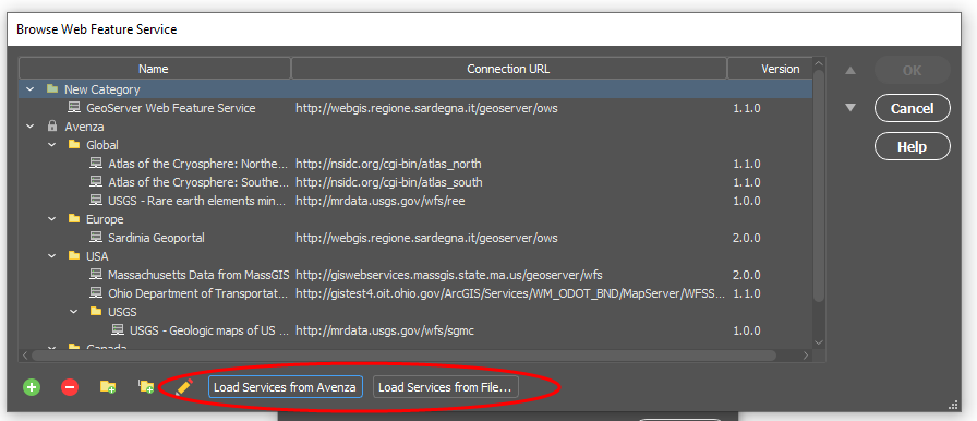
To import from WMS or WFS, go to Import or Multi Data Import, and choose Web Map Service, or Web Feature Service from the Format listbox. Once you’ve selected the source you’d like to use, load services from Avenza (pre-loaded services) or, import your own from a file.
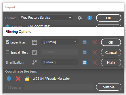
Once you’ve selected your specific service, you can select the layers you’d like to import. Information such as layer name and description is included. There is also the option to use the spatial filter directly in the layer selection box, to use the extents of another layer to specify, or specify exact coordinates to limit the area being imported.
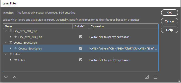
When importing data from WMS or WFS, you have the option to use the spatial filters, layer filters (attribute expressions included!) and simplification. These options allow you to filter the data to better suit your needs.
If you’re importing from ArcGIS Online, you’ll need an ArcGIS Online account, and an internet connection. Once you’re logged in, you’ll be able to select data to import. When importing data, you can choose Feature Layers, Map Image Layers, and Tile Layers to import.
When importing Feature Layers, you’re able to filter the data as well. Once you select the Feature Layer that you’d like to import, you can choose to ‘Edit Query’ and write a SQL statement to narrow down the features or attributes you’d like to import.
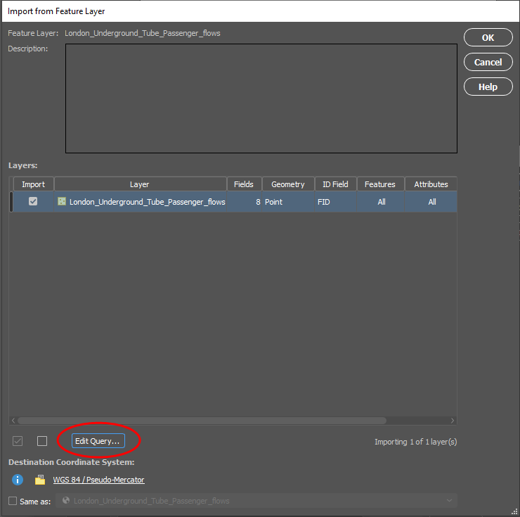
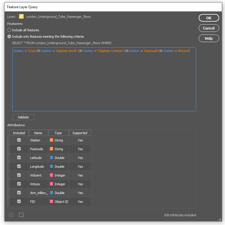
Once your query is made, your data can be imported.
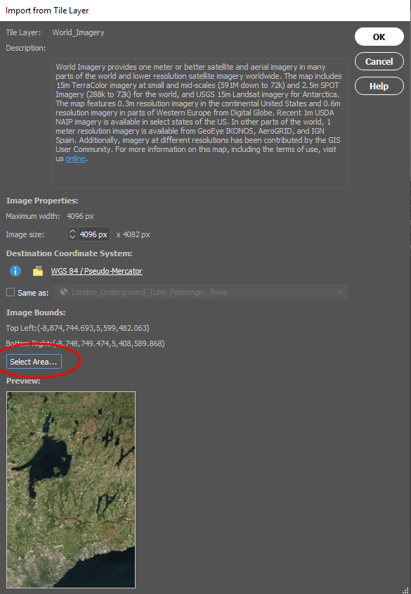
If you want to import Map Image Layers or Tile layers, you’re able to choose a specific area to import, very similar to the Spatial filters available when importing other files. Using the ‘Select Area’ option can help reduce the size of the image you’re importing and helps crop data before you import it, so you’re not importing large amounts of data you’re not going to use.
In order to import from ArcGIS Web Service, you’ll need an ArcGIS Web Service URL. Previously imported services are saved in the Service URL drop-down list.
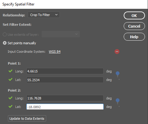
Lastly, if you’re importing data using the PostGIS option, you also have the ability to filter your data. You can specify a Spatial Filter, and manually set the coordinates for points 1 and 2.
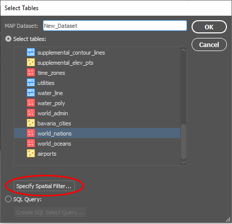
This will allow you to import only the data you need! You can also filter your data using a SQL query, which will help reduce the number of features or attributes you need to import.
Importing from different servers can be a great way to get different data. The best part about importing from servers is that MAPublisher allows you to filter as you import, just as you can when importing other file types. Crop or query the data as you see fit, regardless of where the data came from!