


Welcome back to this month’s edition of Mapping Class. The Mapping Class tutorial series curates video tutorials and workflows created by experienced cartographers and Avenza software users. With us today is Steve Spindler, a MAPublisher expert, and professional cartographer. Steve is back with a quick demo showing how he uses MAPublisher path utility tools and a custom Adobe script produced by Nathaniel Kelso to create unique mile marker symbols. The Avenza team has produced video notes adapted from the original article found on Steve’s personal blog.
***
Create Distance Marker Symbols in MAPublisher using Scripts
by Steve Spindler (Notes adapted from the original)
MAPublisher used within Adobe Illustrator enables us to create mile markers or other points along a line. I’m using this tool while working on the Genesee Valley Greenway map, and this video walks through the process.
Not shown in the video is how I set the direction of the line. Reversing the line direction is done using the MAPublisher Flip Lines tool. I just didn’t need to do this.
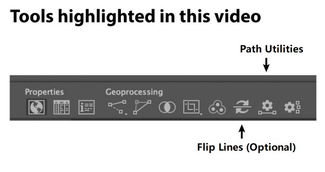
To set the mile marker preferences, we can use the Add Path Intervals in the Path Utilities tool.
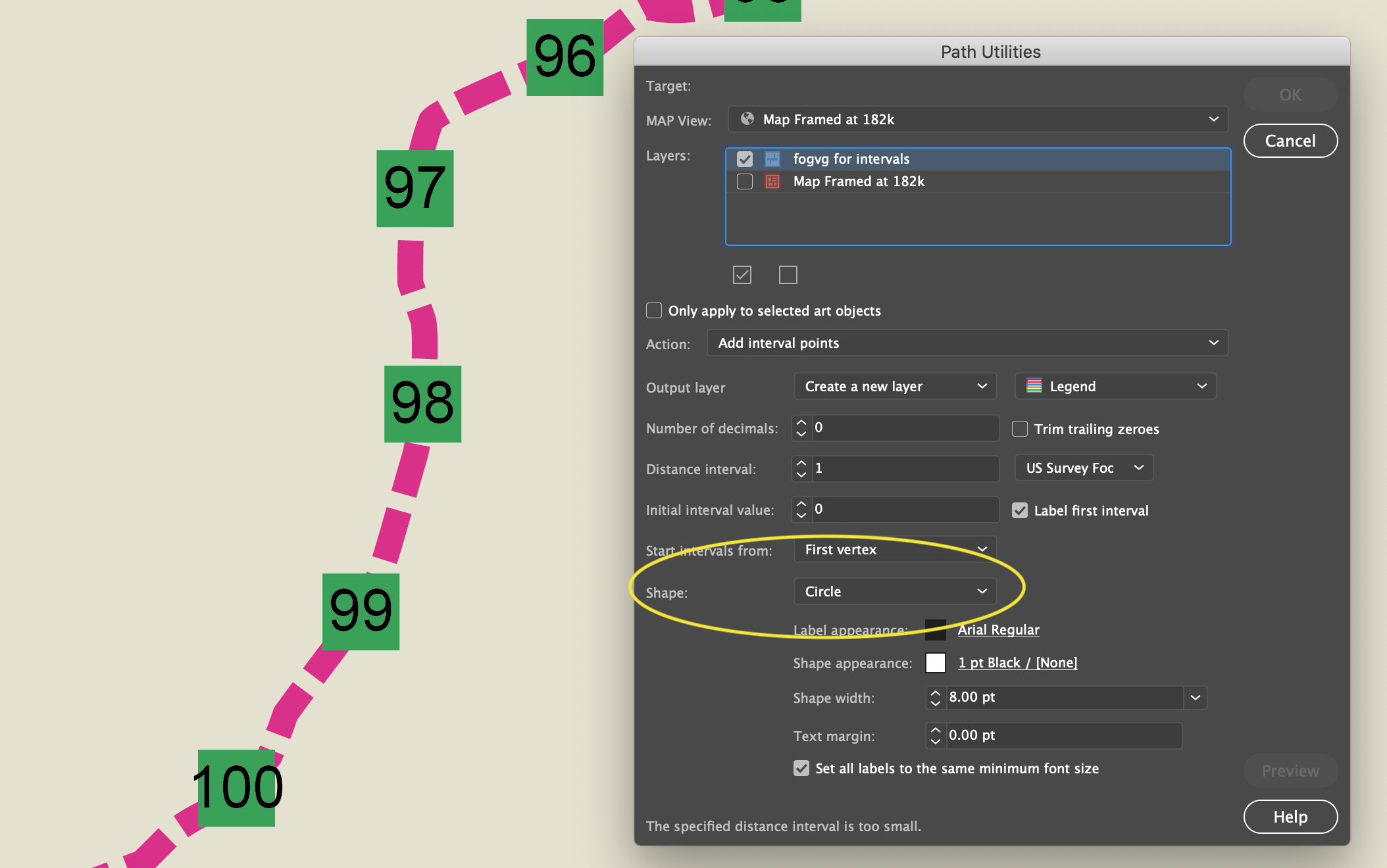
This is pretty good, but if you want to customize the circle or square, it helps to convert the polygon objects into symbols.
Find and Replace Symbols Script
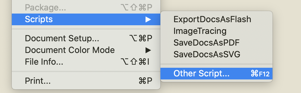
The script is called “Find and Replace Graphics” and can be found on Nathaniel Kelso’s website here. Save the script into the appropriate Adobe Illustrator Scripts folder. If you prefer, you can save the script elsewhere and navigate to the script manually using “File>Script>Other Script…”
Note: Save the script with the “.js” extension
To use it, I select all of the current objects that I want to replace and make sure they are on the same layer. I lock other layers. Then I add place a symbol on the same layer (ensure the symbol you want to use is the top-most object in the layer).
With the objects selected, run the script here.
All of the selected objects will be changed to the top-most object, which I set to be a symbol.
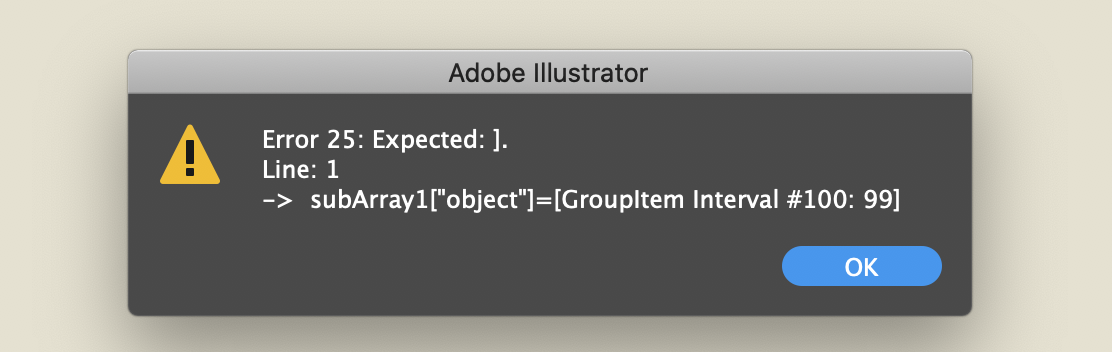
Select only the polygons, not the text. Otherwise, you will get this error.
***
About the Author
Steve Spindler has been designing compelling cartographic pieces for over 20 years. His company, Steve Spindler Cartography, has developed map products for governments, city planning organizations, and non-profits from across the country. He also manages wikimapping.com, a public engagement tool that allows city planners to connect and receive input from their community using maps. To learn more about Steve Spindler’s spectacular cartography work, visit his personal website. To view Steve’s other mapping demonstrations, visit cartographyclass.com