Originally published in Directions Magazine. http://www.directionsmag.com/articles/the-itunes-of-maps-a-new-business-model-for-map-publishers/280993
By Joe Francica
Summary:
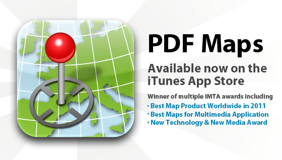
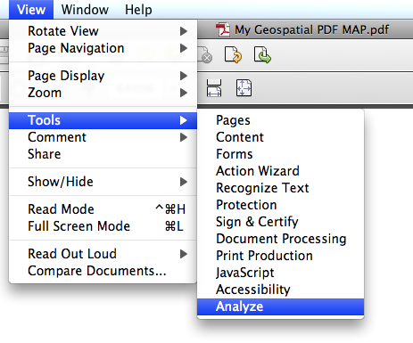
In September 2010, Avenza Systems, Inc. released the first version of PDF Maps for the Apple App Store where both free and for-pay versions of maps in the Geospatial PDF format could be downloaded for use with the iOS operating system. Currently, over 100,000 maps are now available for download. Are users likely to download maps normally found in a print version to their iPhone or iPad? Editor in Chief Joe Francica sat down with Avenza president, Ted Florence for more details on the “the iTunes of maps” business model – selling maps the way iTunes sells music.
Directions Magazine (DM): The transition from publishing printed paper maps to the digital world is a difficult one for many publishers who have been in the map business for many years. Why has the transition been so slow when we’ve had online mapping and the platform, the Internet, for many years?
Ted Florence (TF): Most publishers who have heretofore catered to the printed map audience have neither the means, the know-how nor financial capability to jump into the digital world, and hence a real catalyst was required. That is the essence of where Avenza’s PDF Maps app and digital map store solution come in. While the migration from analog product to digital product has unfolded over the last few years and the better part of the last decade for book and music publishers, map publishers (save for those with means of their own) have only been able to enviously sit back and watch as their printed map businesses have started to struggle. And recognizing that catalysts like Apple, with iTunes and iBooks, and Amazon, with Kindle, have made themselves available to music and book publishers, one could argue that were it not for those catalysts, music and books may not have made the migration either. Furthermore, the cost of transitioning can be very expensive and even prohibitive for many publishers, not to mention that undertaking such major initiatives as creating their own app or mapping device could likely distract most publishers from their main business of producing and delivering maps. So again, despite the fact that the paper or analog to digital transition has proven to be a viable model in the book and music industries and the demand for digital maps has increased with the advent of powerful smartphones and tablets, the map industry has lacked a similar manner of both transitioning and ultimately transacting in maps and has thus been faced with the simple dilemma of how to make that transition, at least until now.
DM: You’ve come up with a new model to support the transition by taking the archive of printed maps and exposing a new delivery method for the publishers. Can you explain the business model in some detail?
TF: The business model for the Avenza PDF Maps app and map store solution is very simple. Think of it basically as iTunes or Kindle but for maps.
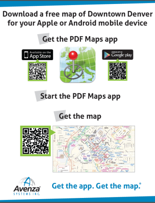
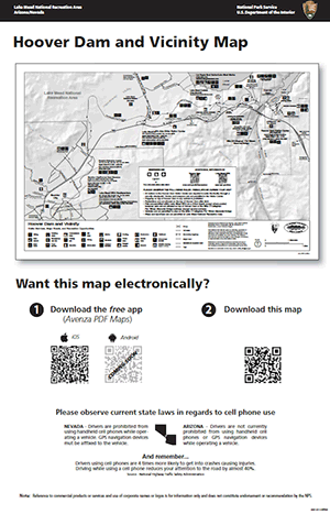
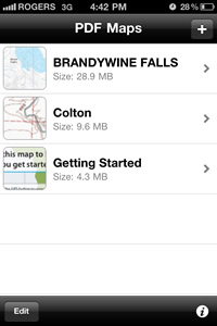
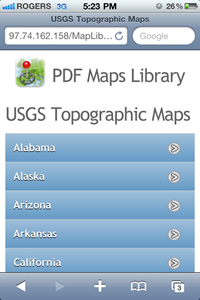
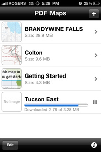
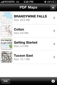
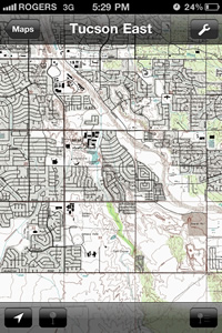
The PDF Maps app and solution is an all-encompassing solution for the use, distribution and sale of digital versions of paper maps to mobile devices. Similar to iTunes for music, the Avenza PDF Maps solution includes both an app for users to discover, purchase and use maps directly from and to their devices, as well as a back-end store to facilitate the transaction and delivery of the maps. The app on the smartphone or tablet device contains all the functionality for using maps both on- and offline, including locating oneself, measuring, plotting points, importing and exporting points, and much more, all of which goes well beyond traditional paper map usage. Users can carry around dozens of maps on their device just like they are now accustomed to carrying around a library of music or books. On the other side of the equation, and again like iTunes and Kindle, the app has a built-in map store which connects users to a vast and growing library (currently over 100,000 titles) of maps from around the world and representing multiple genres and publishers. Users may browse and search through this catalog and quickly and easily find, purchase and download the map or maps of their choice, may of which are offered free of charge. Maps are then immediately and automatically delivered wirelessly to the device.
Any geo-referenced map may be uploaded to the system and made available for purchase in a fully electronic manner similar to the way in which music, videos, books and apps are currently sold and delivered.
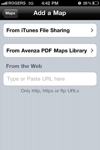
Additionally, users may add their own maps directly into the Avenza PDF Maps app via a variety of methods. This is particularly useful for private and public-sector organizations that have a need to use their own private maps out in the field while doing work on tablets or smartphones such as iPads and iPhones. So the insertion of maps into the app is not exclusively dependent upon a purchase and download from the in-app map store.
DM: If your new model is essentially “the iTunes of maps” why wouldn’t one of the larger publishers like National Geographic or Rand McNally try to use their brand to do this themselves?
TF: This is certainly an option for all publishers, and some will do that, however, as many publishers are finding, the development and ongoing maintenance of such a dedicated app is very time-consuming and costly. That is why one of the business models in the Avenza PDF Maps solution is a customized or OEM offering of the Avenza PDF Maps app whereby publishers can avail themselves of the functionality and transaction model of the Avenza PDF Maps solution without the time and overhead required to do it all themselves. Moreover, though, as we look at the trail blazed in the music and book industries by iTunes and Kindle, we find that all the various publishers have gravitated to a one-size-fits-all solution in which all music publishers provide their offerings through a single place, iTunes, and all book publishers do so though a single place like Kindle or iBooks. What we do not see are dedicated apps for each publisher. We do not see individual music players and digital stores for Sony, Arista, Def Jam or Geffen nor do we see individual readers and digital stores for Penguin, Random House or Harlequin. Furthermore, on the user side, the fragmentation of the offerings is really not ideal or desirable as users do not want to have dozens of music and book apps on their devices in order to find, maintain and use their content. Simply put, why reinvent the wheel? We have seen how successful the digital music and book transition has become under this model, so why should we try to be any different in transitioning the map industry?
DM: Give us a better understanding of the app delivery method. How do you envision the store to function and what “departments” will you have in the store to make it easy to find content?
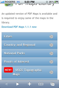
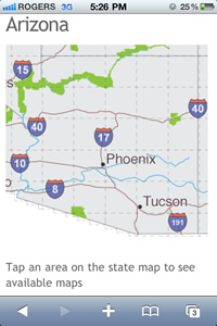
TF: Just like with iTunes, iBooks and Kindle, users can access a digital map store directly from within the Avenza PDF Maps app on their device. From within the map store they can browse various map categories or genres such as tourist, transit, recreation, nautical, aeronautical and special purpose, or enter any search term that might apply to a map they are looking for such as a geographic place or term or a particular map use case such as cycling or camping. Additionally, the map store interface allows for finding maps near to one’s current location, browsing recent additions to the map store and browsing the most popular maps at the time. Searches by publisher or brand may also be performed should users have a particular brand or publisher loyalty.
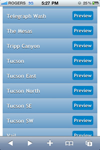
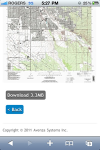
Once they have located a particular map of interest they can simply touch the listing to reveal more information about a map such as publisher, date of publication, file size and full description and even see a full preview of the map in order to feel comfortable that they have found a map they want to purchase. Then, as is done with music in iTunes, they simply touch the “buy” button and complete the transaction.
On iOS devices (iPads, iPhones and iPod Touches) the payment comes seamlessly via the user’s iTunes account and then the map is delivered to the device. Essentially the system functions with the same elegance and simplicity that users are accustomed to when purchasing music and books.
DM: What does the store look like in three years? How do you envision the model developing over time?
TF: Currently there are over 100,000 maps in the map store from over 200 government and commercial publishers and more are being added all the time, every day. We expect this to continue to grow and eventually become the de facto place to purchase maps, much like iTunes has become the place to get music. It would not surprise me at all if we had over one million maps and many millions of users within two to three years. Just ask yourself this: If you need a map of a particular place for a particular use on your device, do you know where to get it? Well, we intend to answer that question for everybody, with the answer being the Avenza PDF Maps store.
There is no other model like this catering to the map industry and as more and more users discover it and more and more publishers realize it to be a viable and costless solution for them to enter the digital map business we see it indeed becoming the iTunes of maps.
We are currently working on an Android version of the solution followed by Windows Mobile and possibly Blackberry, as well as a Web-based interface and store for users who might prefer to do their map shopping on a computer screen rather than on the mobile devices themselves. This is something that music and book purchasers are already able to do, so why not maps as well? As these platforms are unveiled, continued growth is anticipated as new audiences get added. There is no doubt that there is a demand for this type of user and publisher solution so essentially the sky is the limit.