


MAPublisher 8.4 introduces two new related features: to import supported image formats directly from the MAPublisher Simple and Advanced Import dialog boxes and the Image MAP Layer feature type. To import a georeferenced image into the current MAPublisher 8.3 (and earlier) requires you 1) to create a new MAP Layer for an image to be placed, 2) use File > Place to place an image into the Adobe Illustrator document, and 3) to use MAPublisher Register Image to align with the vector work. With MAPublisher 8.4, these steps are streamlined and it will be much simpler to deal with georeferenced image files.
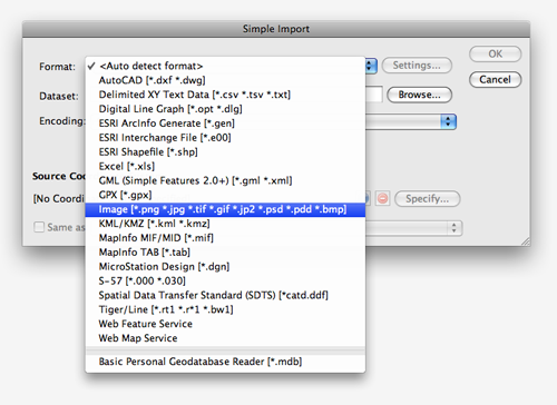
Below is the Simple Import dialog box. The new Format option, Image, is added to the drop-down list. Supported images include: PNG, JPG, TIF, GIF, JP2, PSD, PDD, and BMP.
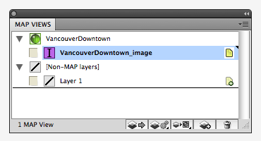
The VancouverDowntown.tif file was selected from the MAPublisher Quick Start dataset. The source coordinate system of the image, “NAD 83 / UTM Zone 10N”, is automatically detected because it is a GeoTIFF and contains the georeference information of the image.

When the georeferenced image is imported by MAPublisher, it is stored in a new layer called “VancouverDowntown_image”. MAPublisher 8.4 introduces a new MAP Layer feature type called “Image”, a purple icon with the letter ” I “. From now on, all images should be placed on Image MAP Layers.
Remember that images placed in Adobe Illustrator using MAPublisher cannot be transformed or reprojected into another coordinate system. To transform an image from one coordinate system to another, it must be done using another software such as Geographic Imager.
MAPublisher 8.4 will be released very soon. Thanks for sending us feature requests like this one. If you have any feature requests for MAPublisher, Geographic Imager or PDF Maps, please feel free to drop us a line at support@avenza.com. We’re always happy to hear from you!