


Editing geospatial imagery like aerial photos or images taken from satellites is usually a difficult task and requires a certain level of technical knowledge. However, the Geographic Imager plugin for Adobe Photoshop makes GIS accessible to a growing group of graphics professionals who can quickly and easily edit geospatial images. Cartographers, design-focused users and image editors can combine the geospatial editing tools of Geographic Imager with the Adobe Photoshop design environment.
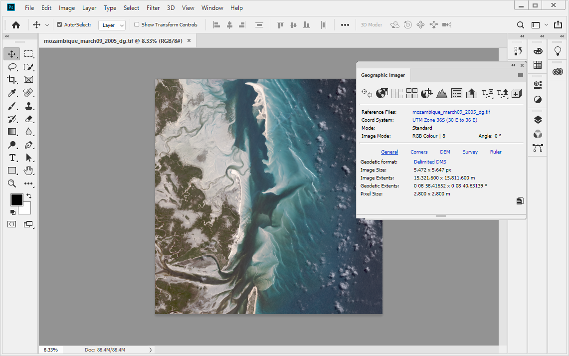
With the Geographic Imager plugin for Adobe Photoshop, you gain access to all the tools and spatial information related to the image quickly and easily through a seamlessly integrated panel. Easily and quickly import various data formats, transform coordinate systems, and crop, mosaic or tile images. Save images to several industry-standard geospatial formats or export as web tiles to use in web applications.
The latest Geographic Imager plugin release provides tremendous performance and user interface improvements as it was built on Adobe’s Unified Extensibility Platform (UXP) in Photoshop. This platform offers more flexibility and opens up opportunities to develop new tools.
Geographic Imager features include:
- Extensive geospatial image support
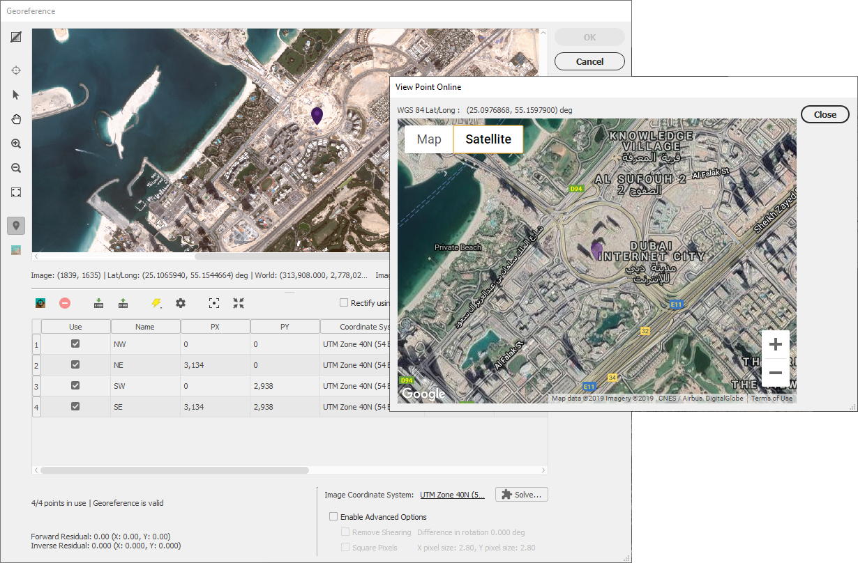
- True spatial-awareness by georeferencing images
- Extensive support for thousands of geographic and projected coordinate systems, maintaining accurate map projections during image editing
- Mosaic individual images to create a seamless image
- Tile an image into multiple images by tile size or count and automatically save them using sequential naming
- Import digital elevation models (DEM) and create shaded relief maps using the Terrain Shader tool
- Save spatial images to many industry-standard formats, including GeoTIFF
- Export to web tiles to generate images that are compatible with Google Maps, OpenStreetMap, MapBox and more
- Ability to use Geographic Imager tools with Adobe Photoshop scripting
How to get Geographic Imager for Adobe Photoshop
Geographic Imager for Adobe Photoshop is now available in the Adobe Marketplace for both Mac and Windows. Alternatively, you can try Geographic Imager by registering for a free trial.
Users ready to purchase can use the code AVENZAMAX10 at checkout on www.avenza.com for a 10% discount.
For additional information about the Geographic Imager plugin for Adobe Photoshop, please refer to the following resources: