


Today we are shifting the spotlight to Geographic Imager, our plugin for Adobe Photoshop. This blog features the usage of the Terrain Shader tool, which was featured in our promotional video at the Adobe MAX conference last week!
Terrain Shader is great for adding dimension to your maps. It is commonly used to perform shaded relief, a method for representing topography on maps in a natural and intuitive way. The tool provides options to apply colourization schema and shaded relief to supported elevation data formats, such as DEM or SRTM files. Terrain Shader has several different settings that users can customize to create a shaded relief that best suits their needs.
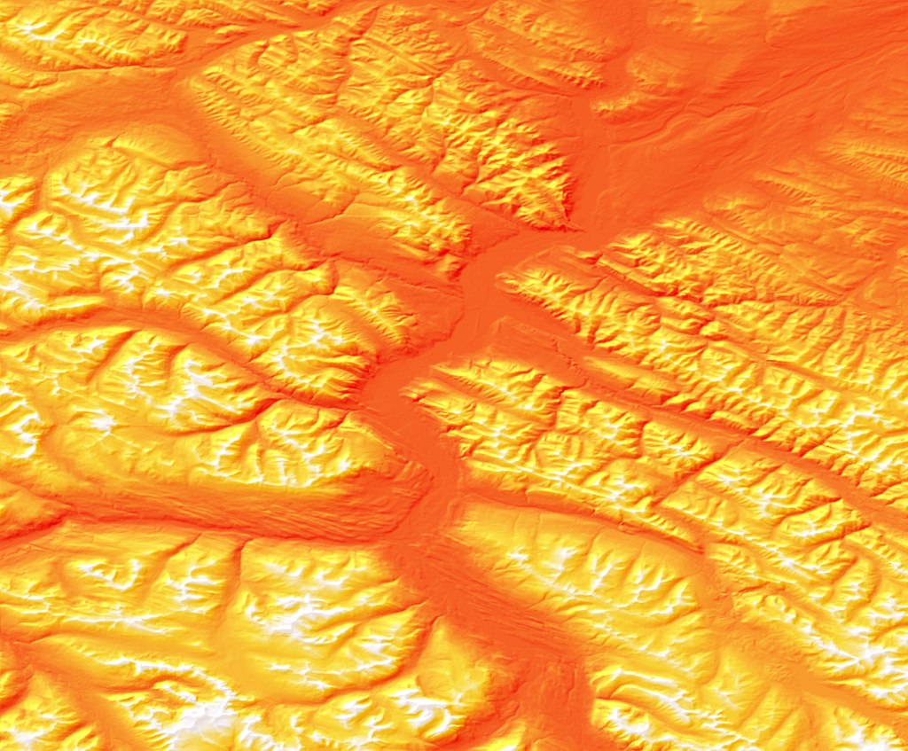
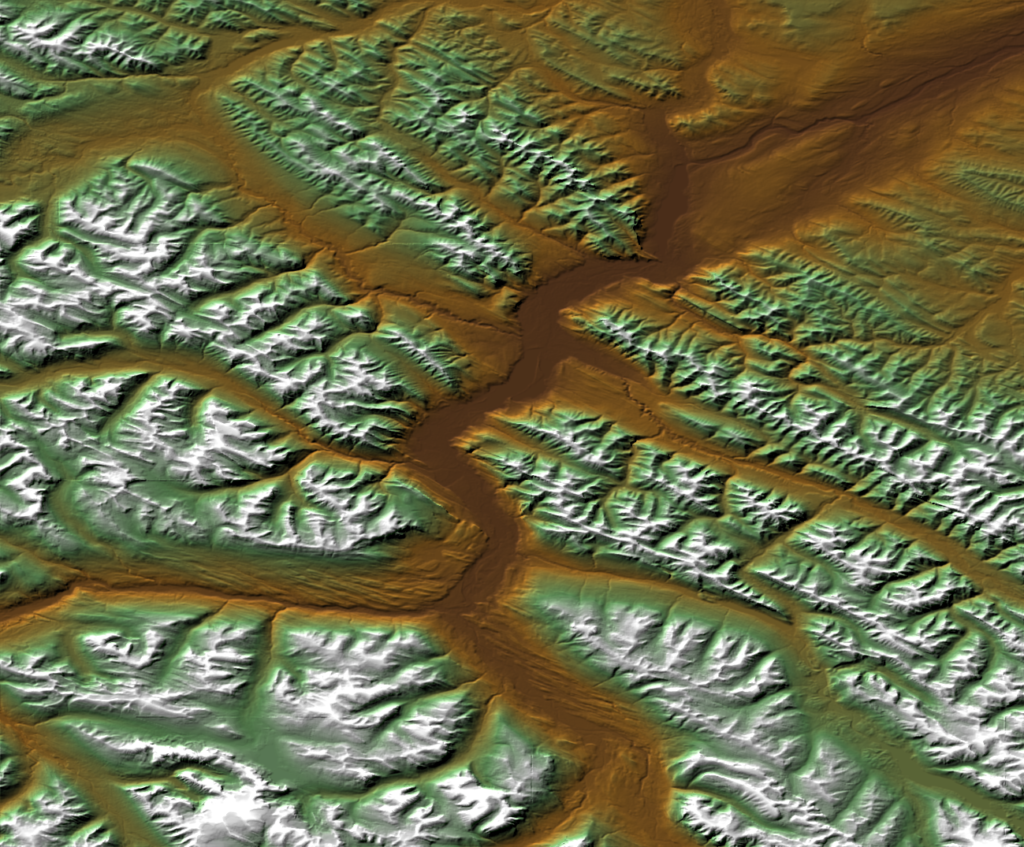
In the spirit of Halloween, we’ve decided to show off the Terrain Shader tool by creating a fun shaded relief using a colourization schema that resembles candy corn!
I’m starting with a DEM file covering a portion of Jasper National Park in Alberta. DEMs are imported by default using a black-white gradient, with black representing the lowest elevation and white representing the highest.

Next, you can open the Geographic Imager panel and select the Terrain Shader button.

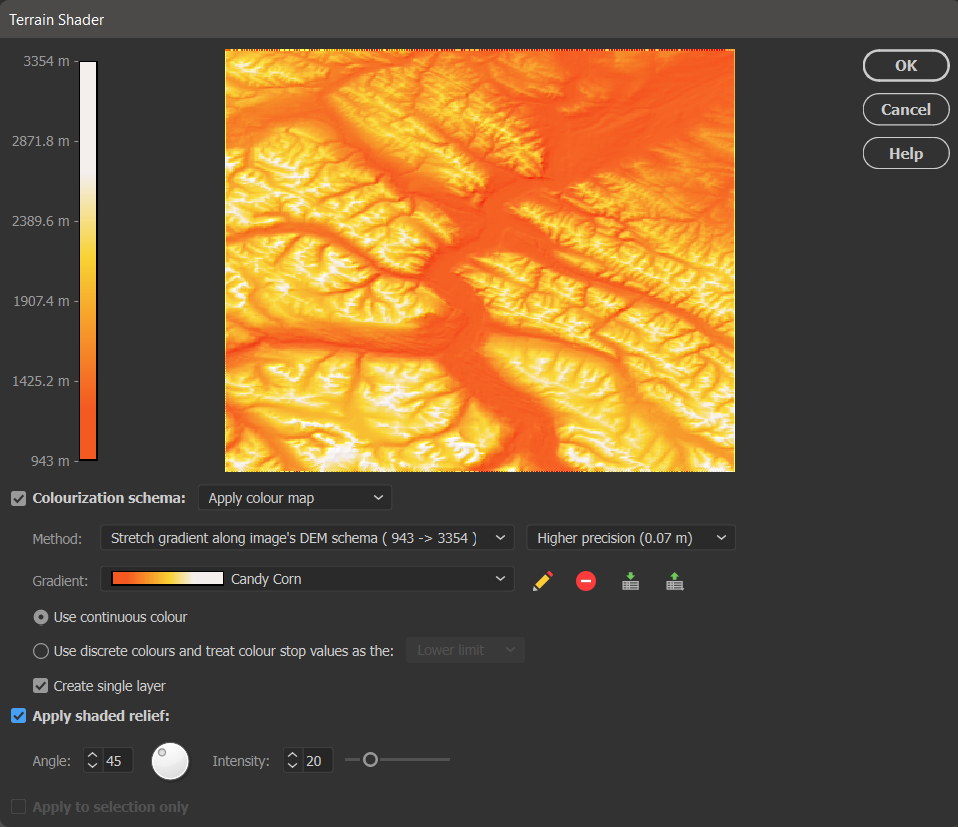
There are many different settings available in the Terrain Shader tool to customize your design. First, ensure the Colourization schema option is checked and set to “Apply colour map” which enables you to apply colour to your DEM. You can also choose the Method to stretch the colour map over a preset group of values or simply apply your colour ramp from the highest and lowest point on the DEM.
Next, you want to select any Gradient from the list and press the pencil icon to open the Colour Map editor window. From this window, you can set and adjust three different colour stops to represent the three candy corn colours you wish to apply to your map.
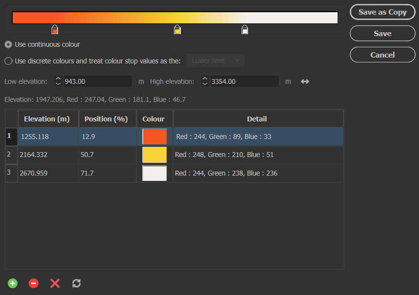
When you are finished, be sure to click Save and save it as a new colour map, titled appropriately (in my case, it was “Candy Corn”).
Finally, select Apply shaded relief and adjust the light source angle and intensity if desired. Shaded relief is what adds texture to your DEM to make it look like terrain.
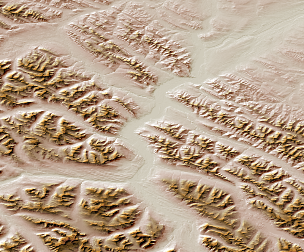
Click OK, and you have successfully created your very own candy corn mountains! This is just one fun way to make use of the terrain shader to add a personal touch to your map. See the final result below, as well as a few other examples of colourization schemas that can be used to add a more realistic feel to your terrain.
For more information about the Terrain Shader tool, check out our related Support Centre articles and tutorial!