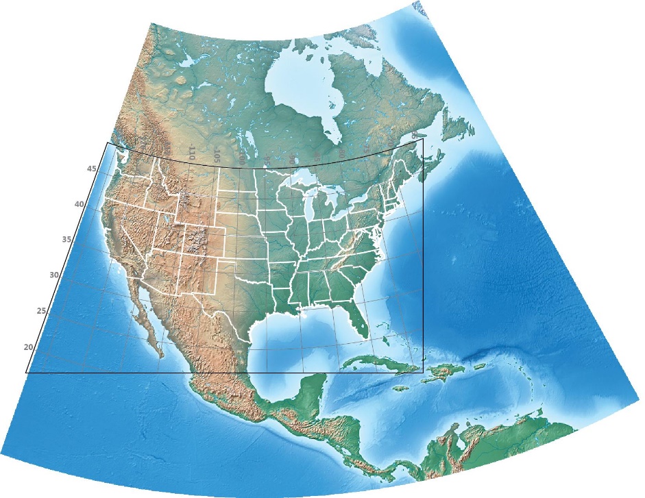
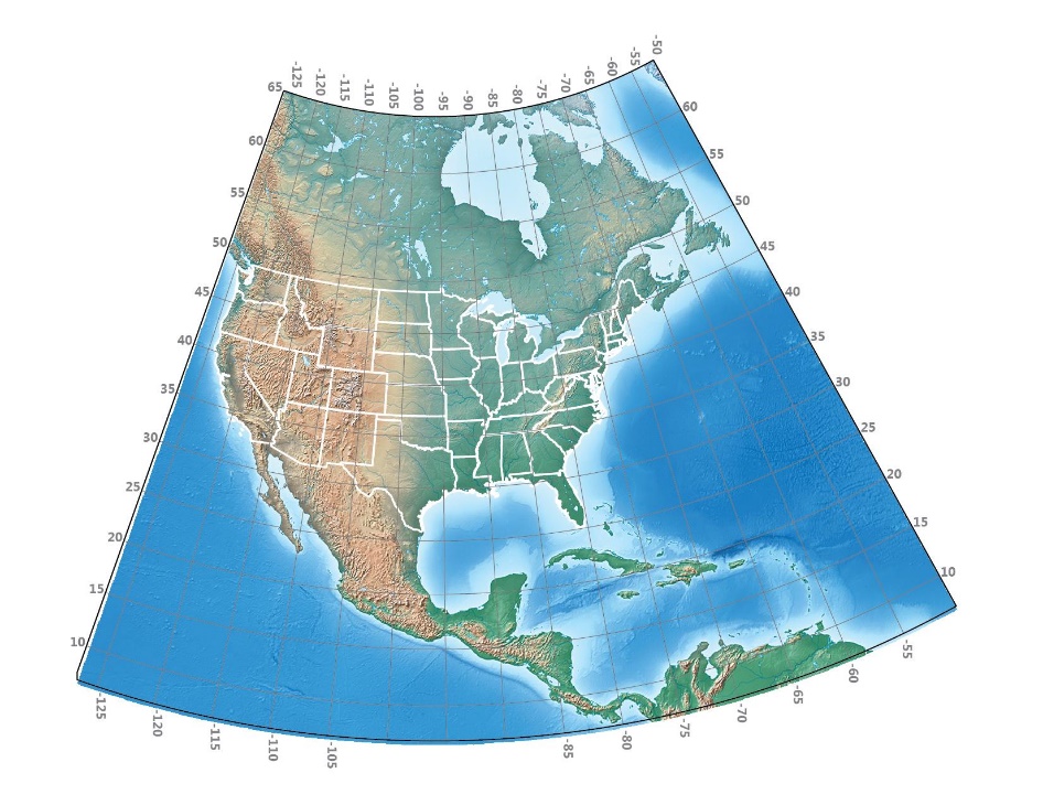
A graticule is the network of lines of latitude and longitude drawn at regular intervals on a map. Graticules are created in MAPublisher using the Grids and Graticules tool. In some maps, you may want to limit the area on the map that a graticule covers. For example, you may want it to cover only the map’s area of interest. The image below is a map of North America with a graticule drawn at 5-degree intervals. US State boundaries are drawn in white. In this post, we’ll modify the graticule three times so it conforms to the edges of the image, so it covers only the Continental United States, and lastly a combination of the previous two modifications.
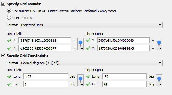
MAPublisher can limit the geographic extents of a graticule in two ways: using Grid Bounds and using Grid Constraints. In both cases, you’ll specify the lower left and upper right corners of the graticule. Specifying Grid Bounds will limit the extent of the graticule to a rectangular area while specifying Grid Constraints will limit the graticule along lines of latitude and longitude. If both Grid Bounds and Grid Constraints are specified, the graticule will cover an intersection of the two areas. The image below shows bounds and the constraints and the intersecting area which forms the graticule.
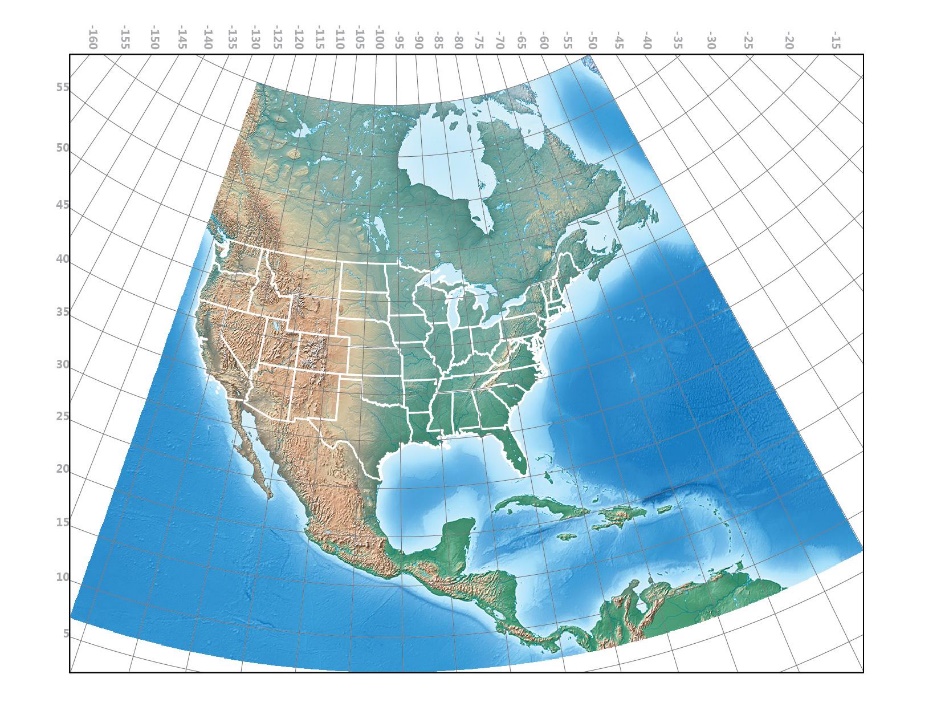
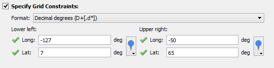
To modify a graticule so that it conforms to the edges of the image, you’ll need to specify grid constraints. In the Grids and Graticules dialog box, click the Specify Grid Constraints check box and set the Lower Left and Upper Right corners to the corners of the image which are -127°, 7° and -50°, 65° respectively.
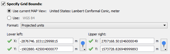
 To create a rectangular graticule covering only the lower 48 states, click the Specify Grid Bounds check box and set the Lower Left and Upper Right corners to the corners of that area. Tip: click the MAP World Locations drop-down arrow to choose the values for the lower left and upper right corners.
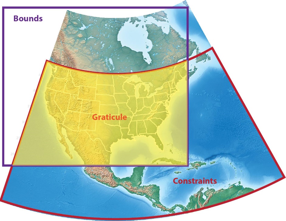
 When both Specify Grid Bounds and Specify Grid Constraints check boxes are both checked, the graticule will cover an intersection of each of the extents. For instance, in the map below, the northern extent follows the 49th parallel at the Canadian border, the western extent is at the edge of the image (127° west) and the south and east extents are the same as in the previous map.