


Maybe you already know that MAPublisher has the ability to let you import shared data layers from your ArcGIS Online organizational account and to connect to publicly available map servers from various online sources. Once GIS data is imported, you can use Adobe Illustrator’s powerful design tools to style and edit your map into a thing of beauty. The ability to import from ArcGIS has been available for a while, however, it’s still a question that people ask our Support Team frequently. So, here’s a reprise of a blog post, from a while ago, that illustrates how to import layers directly from ArcGIS Online or an ArcGIS web service into Adobe Illustrator, using MAPublisher.
Esri’s ArcGIS Online is a collaborative web geographic information system (GIS) that allows you to store and share GIS data using Esri’s secure cloud. Use MAPublisher to import Feature, Map Image, and Tile layers into Illustrator without losing any georeferencing, features, or attributes. MAPublisher does not currently support the use of Map Image or Tile services that use Dynamic layers.
Importing from ArcGIS Online
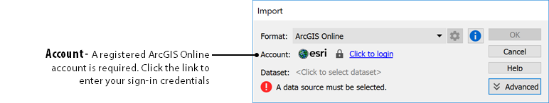
To load a layer, use the MAPublisher Import tool as you would with any data type and select ArcGIS Online from the Format drop-down menu. Click the login link to enter your ArcGIS Online credentials to access your organization’s web portal.
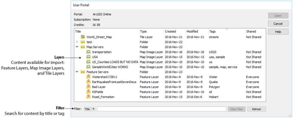
Feature Layers contain vector data that will import as artwork into Adobe Illustrator. You can reduce the time it takes to import by filtering the data first, isolating only the layers that you need.
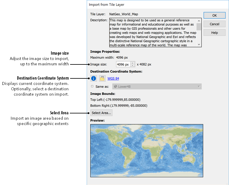
Map Image Layers and Tile Layers are raster data layers that can be added by selecting the geographic extents.
Importing from a Web Service
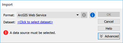
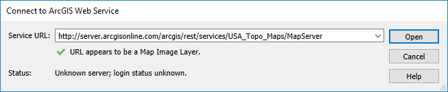
In addition to using your organization’s data, you can get publicly available data by connecting to an ArcGIS Web Service. To connect to a web service, use MAPublisher Import and select ArcGIS Web Service from the Format drop-down menu. Click to select the dataset and enter the URL for the service. This is a great option when searching for data from open data portals created by government agencies.
Import from ArcGIS Web Service
MAPublisher bridges the gap that exists between Esri’s Online services and the full-featured design environment of Adobe Illustrator. You can leverage Illustrator’s tools on GIS data shared within your organization, or from a publicly available source to make better, more beautiful maps.