


What’s New? Geographic Imager 6.3
We are happy to announce that Geographic Imager 6.3 is now available. This release brings continued improvements to compatibility with Adobe Photoshop 2021, and now offers full compatibility with the latest Mac OS 11 Big Sur release. We are also excited to introduce a brand new and easy way to access floating licenses directly from the cloud!
Here is what you can expect with the latest Geographic Imager 6.3 release:
macOS 11 Big Sur Compatibility
Users will be delighted to see that Geographic Imager 6.3 is now fully compatible with macOS 11 Big Sur. This means new and existing users can transition to the latest macOS without any interruption in their Geographic Imager capabilities.
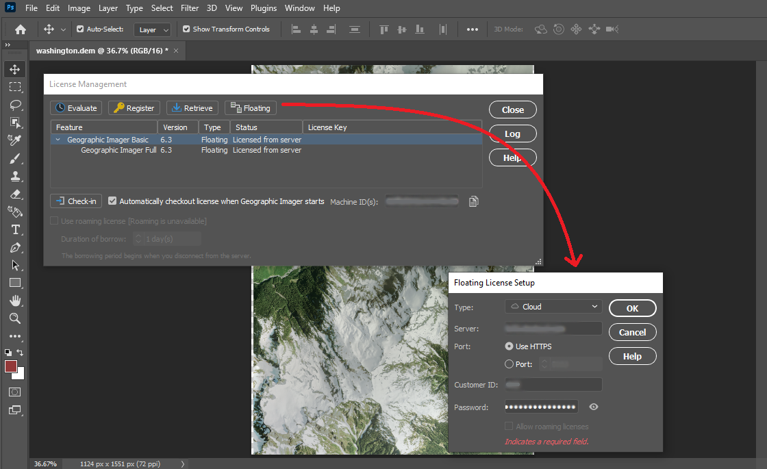
Cloud Floating Licenses: A Better Way to Manage and Checkout Licenses
We have worked hard to deliver a newly improved floating license management system as part of Geographic Imager 6.3. This new license management system greatly improves on previous versions and allows users and administrators within an organization to efficiently and seamlessly access floating licenses directly from the cloud. The new licensing system is built on the RLM Cloud platform and means floating licenses can be implemented without the challenges of setting up, deploying, and managing a local server. Contact our Sales team to learn how you can set up your cloud floating licensing.
See the new cloud licensing options by accessing the license management panel within Geographic Imager 6.3
UXP Implementation for Chinese Versions of Geographic Imager 6.3
The Chinese version of Geographic Imager 6.3 now implements Adobe’s new powerful Unified Extensibility Platform. Which provides user interface improvements and flexibility to develop new tools in the future.
Geographic Imager Available Now
All active maintenance subscribers can upgrade to Geographic Imager 6.3 today for free. Users without an active maintenance subscription or on a previous Geographic Imager version can still upgrade.