


It’s an exciting day for anyone who works with geospatial imagery, especially if your workflow involves editing images in Adobe Photoshop. We released a brand new version of Geographic Imager® – the plug-in for Photoshop that provides tools to make tasks like reprojecting, georeferencing, and terrain shading possible.
In addition to the new features like vector data import and Equal Earth projection support, we also improved many of the existing features that were already there (after all, Geographic Imager has improved the lives of cartographers for many years) and updated the interface so that it looks and feels just like the rest of the Adobe environment. Geographic Imager 6.0 is fully compatible with Adobe Photoshop 2019, and you can find the rest of the system requirements and compatibility requirements here.
Here’s a rundown of the new features you’ll find in Geographic Imager 6.0:
Vector Data Import
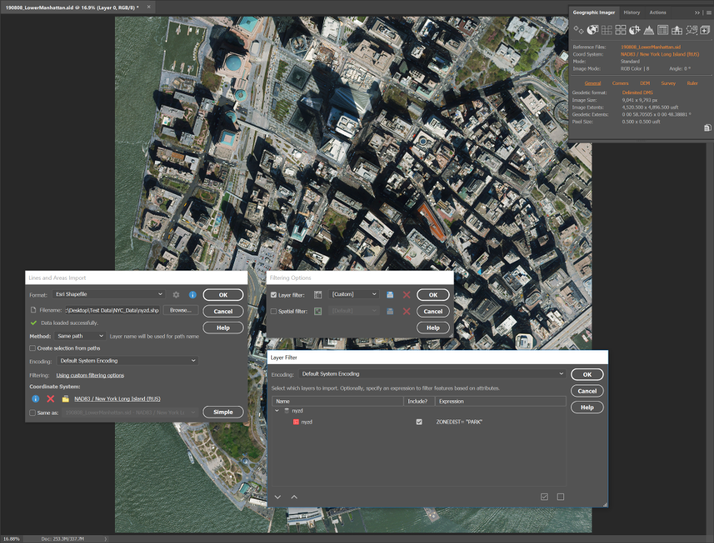
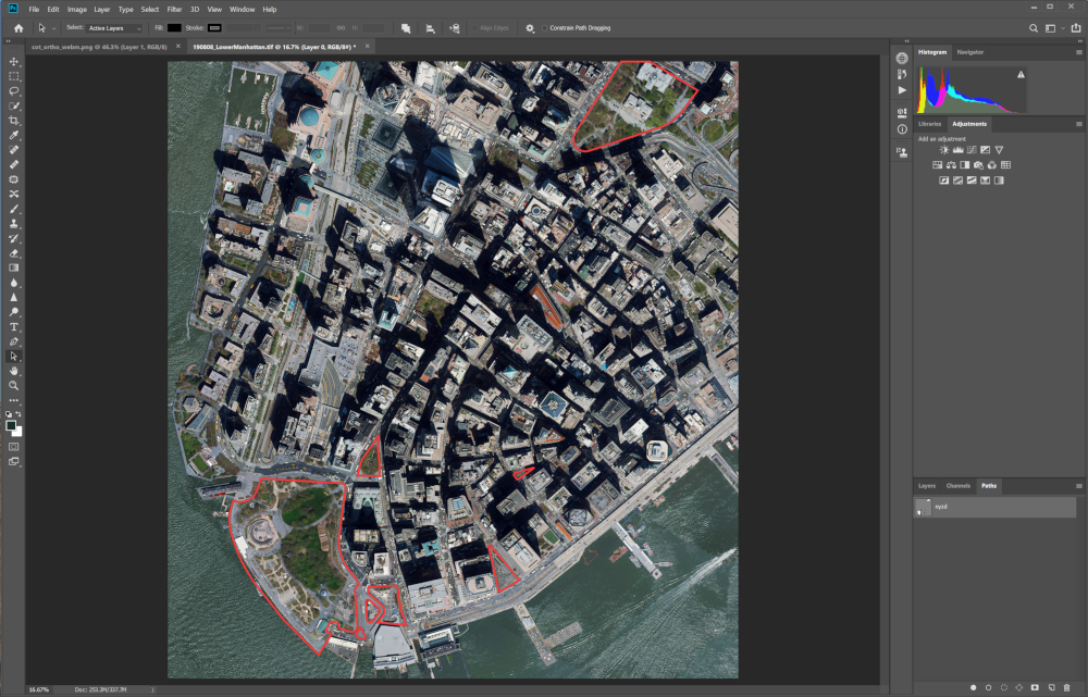
This long-awaited feature allows you to import a number of GIS vector formats directly on to your images. Whether performing a check to ensure accurate georeferencing, QA/QC or simply including supplemental data, these tools will improve the efficiency of your workflows. E.g. you can import your polygons from a shape file and convert them to pixel selections in one simple step!
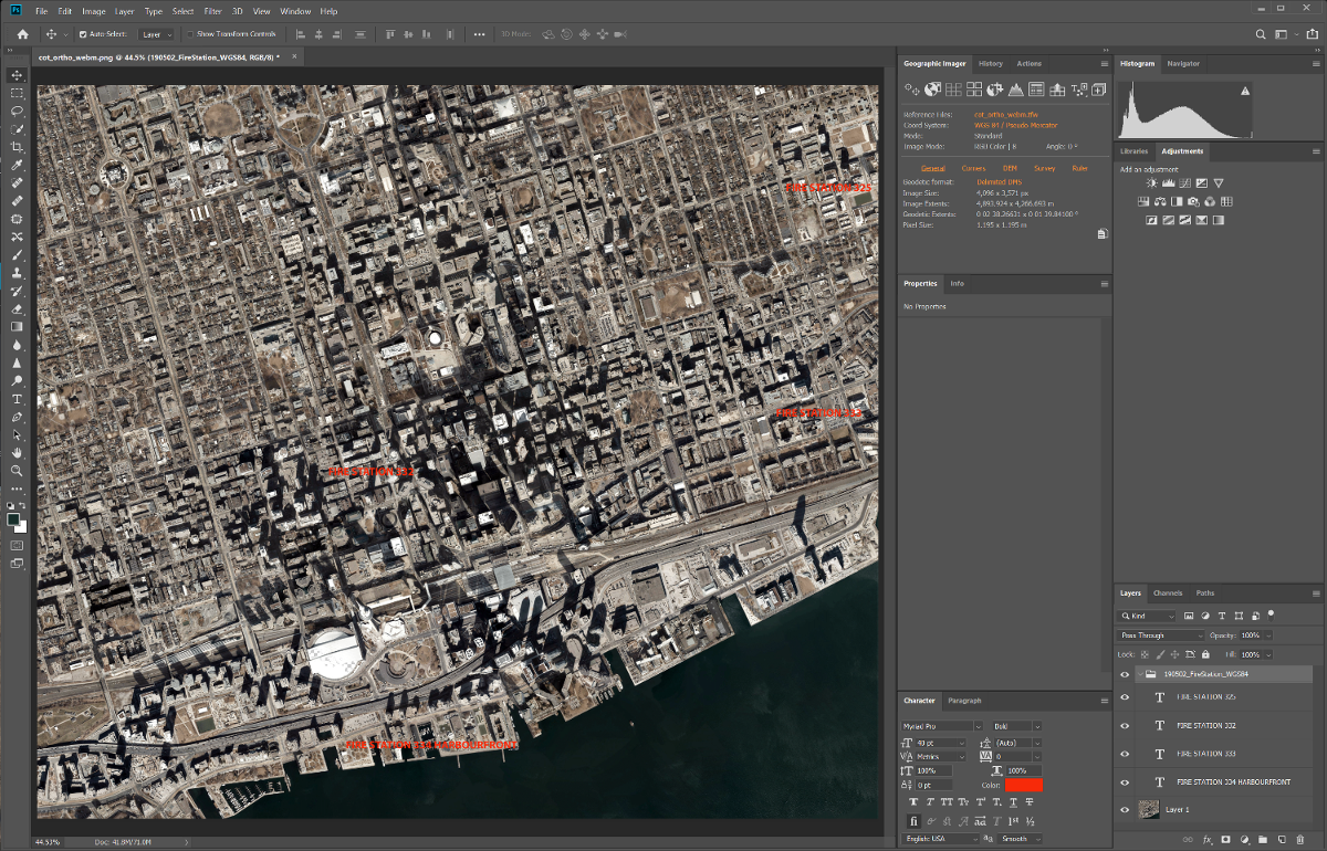
Points and Text Import
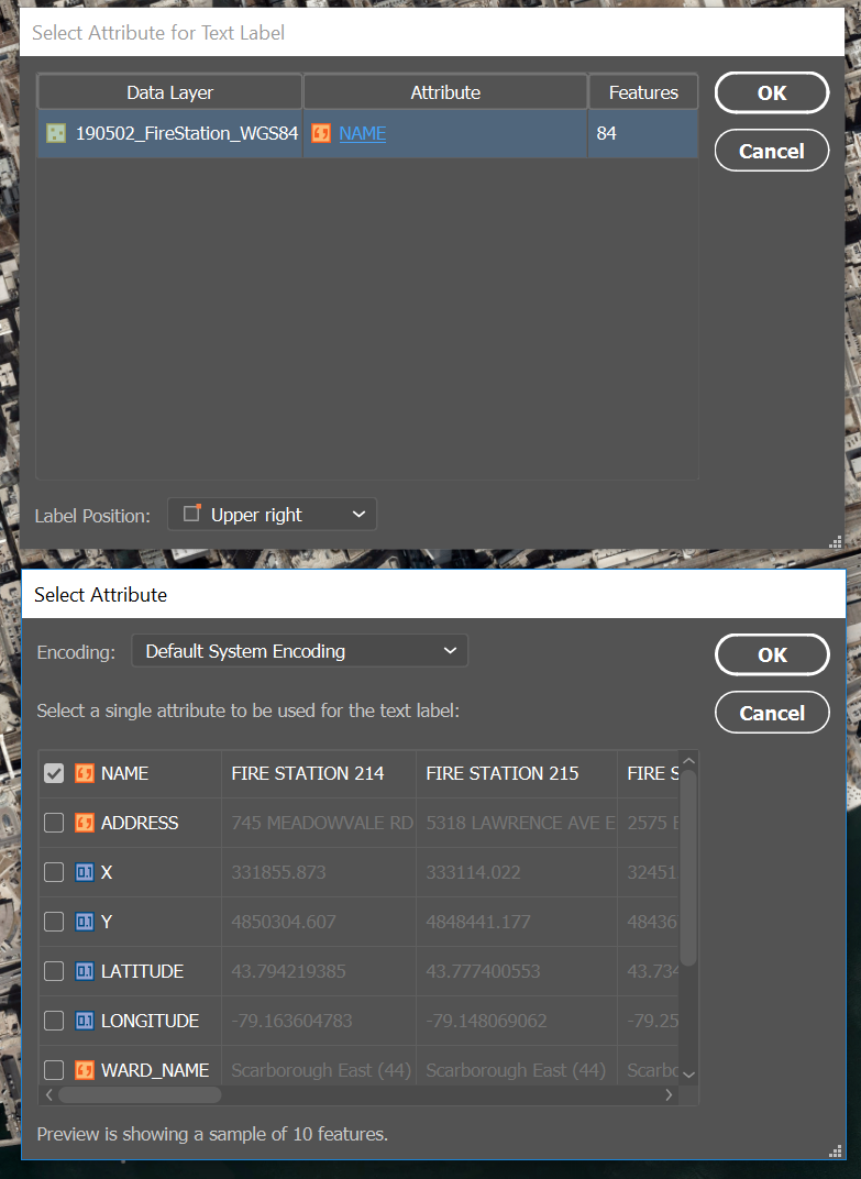
Now you can provide geographic context to your images by importing geospatial text data and converting it to cartographic labels, or simply importing points of interest and overlaying them on top of your image in a few clicks. Datasets consisting of point or text features can be imported as Text Layers or by using the Count or Note tools in Photoshop. When using the Text tool, an attribute may be selected to generate the text and the imported text features are grouped together by layer.
When importing with the Note tool, you can control which attributes to include (or exclude) in the note itself. The name of the layer and the feature it belongs to are automatically added to the note.
When importing using the Count tool, no attributes are imported; however, the points are grouped together by layer for easy identification and management.
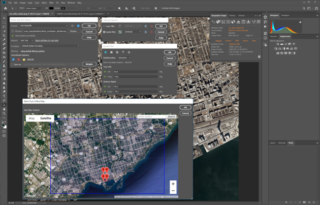
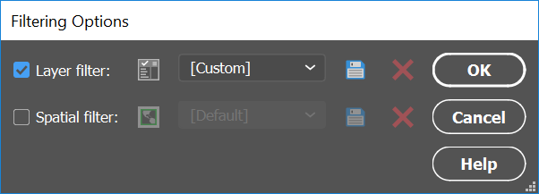
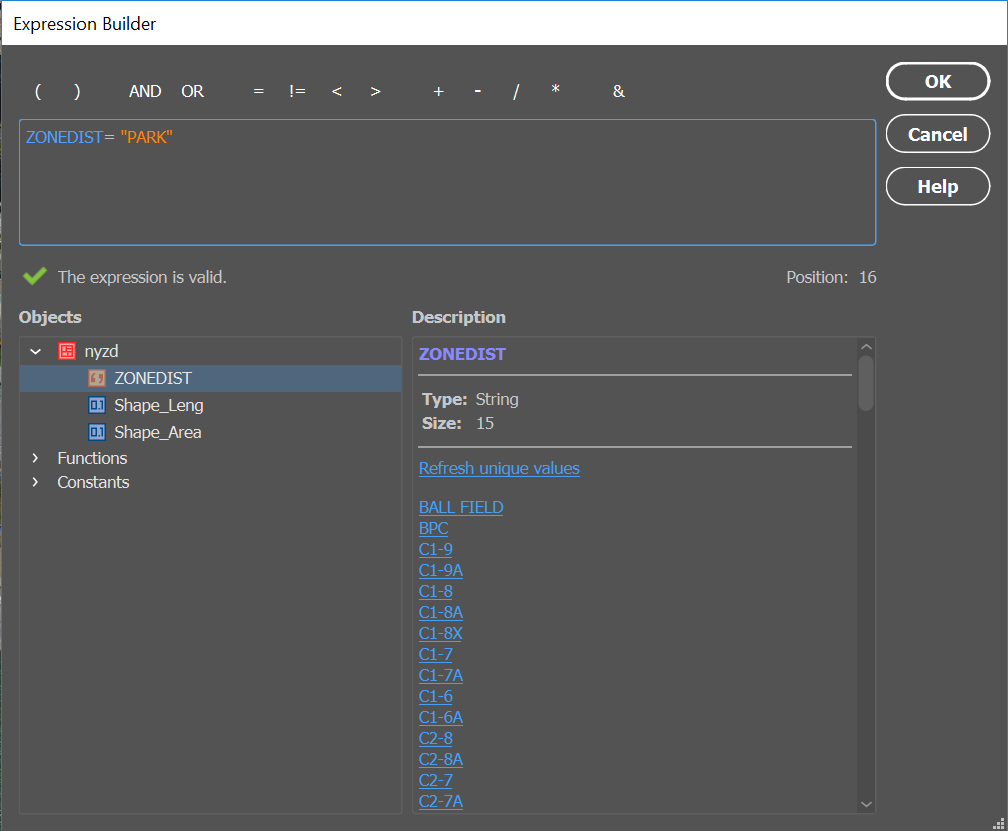
Similar to the import feature in MAPublisher (for Adobe Illustrator), the spatial and layer filters ensure that you only import what you need.
Line and Area Import
Polyline and polygon data can be imported as a single Photoshop path or each feature can be placed on its own path. The ‘Same path’ method is more beneficial when accessing individual features while the ‘Separate path’ method allows for more control over each feature. Here too, you can filter the data on import using spatial and layer filters, and you can choose attributes to use as path names.
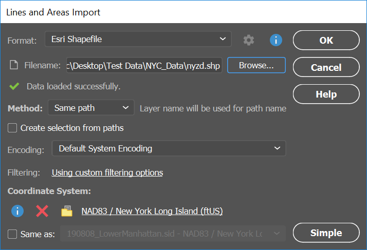
Set your preference before importing for how to handle lines and areas that extend beyond the extents of the canvas; either import only data that intersects the canvas, crop to the canvas, or import everything and allow the data to extend outside of the map area.
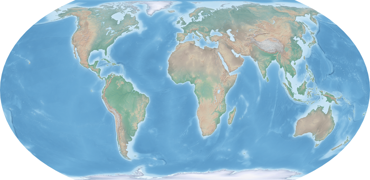
Support for the Equal Earth Projection
The Equal Earth projection is gaining popularity as it is intended to provide a visually pleasing alternative to the Gall-Peters projection, which shows landmasses at their true size relative to each other but drastically distorts their shape. With Geographic Imager 6.0 you can reproject virtually any map using Equal Earth (or hundreds of other supported coordinate systems). All of the geospatial information will be recalculated and preserved in the new projection. It’s that easy!
Look and Feel
We’ve updated the Geographic Imager tools and dialog boxes to more closely match the look of the Photoshop interface. When you change the appearance settings in Photoshop, the appearance of the Geographic Imager toolbars and dialog boxes will change to match. Nice, right?
Simplified Chinese Interface
Working with tools in multiple languages can be confusing. So, when the installed version of Photoshop is configured to use the Simplified Chinese language option, you will be prompted to install Geographic Imager in the Chinese language to maintain the continuity of the Geographic Imager experience. For now, Geographic Imager in Simplified Chinese is available for Windows only.
Try Geographic Imager 6.0 today and see how easy it can be – when you have the right tools – to work with spatial imagery in Photoshop!